Tremor Tracker Présentation
Earthquake data provided by the United States Geological Survey, Earthquakes Canada, Geoscience Australia, Geological Survey of Israel, and the European-Mediterranean Seismological Centre.
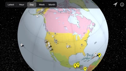
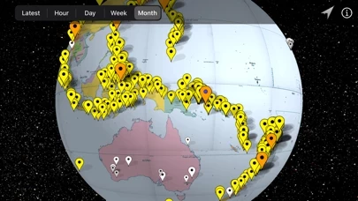
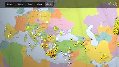
A range (latest earthquake, last hour, day, week, or month) can be selected to display earthquakes within that time frame.
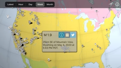
Each earthquake can be tapped to display relevant data including magnitude, location, time, and tsunami warnings.
Captures d'écran officielles
Détails du produit et description de
Tremor Tracker displays recent earthquake points on an interactive globe. Each earthquake can be tapped to display relevant data including magnitude, location, time, and tsunami warnings. A range (latest earthquake, last hour, day, week, or month) can be selected to display earthquakes within that time frame. Earthquake data provided by the United States Geological Survey, Earthquakes Canada, Geoscience Australia, Geological Survey of Israel, and the European-Mediterranean Seismological Centre.