Tremor Tracker Overview
Earthquake data provided by the United States Geological Survey, Earthquakes Canada, Geoscience Australia, Geological Survey of Israel, and the European-Mediterranean Seismological Centre.
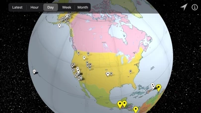
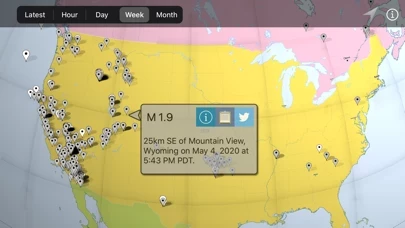
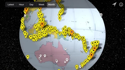
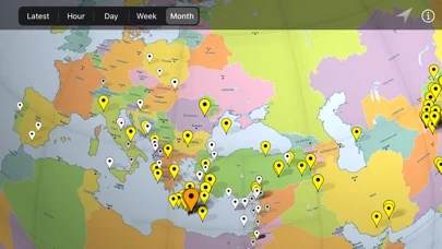
A range (latest earthquake, last hour, day, week, or month) can be selected to display earthquakes within that time frame.
Each earthquake can be tapped to display relevant data including magnitude, location, time, and tsunami warnings.
Official Screenshots
Product Details and Description of
Tremor Tracker displays recent earthquake points on an interactive globe. Each earthquake can be tapped to display relevant data including magnitude, location, time, and tsunami warnings. A range (latest earthquake, last hour, day, week, or month) can be selected to display earthquakes within that time frame. Earthquake data provided by the United States Geological Survey, Earthquakes Canada, Geoscience Australia, Geological Survey of Israel, and the European-Mediterranean Seismological Centre.
Top Reviews
By D'Word Gurl
Great app for quick follow-up on quakes and tremors around the globe!
The color-coded map pins indicating locations of quakes are easy to use and distinguish !when looking at the globe. Zoom in and zoom out works great. Locating large quakes is easy with the color coding. Identify areas of recent seismic activity is easy. The app loads quickly and the developer is responsive to bug reports! Thanks. Great app!
By Floormanchu
Quick easy
Love this app! It’s Fast no Bs! I just wish it had a notification option.
By Cranky***
Great app
This is by far the best and most informative app to watch earth movement.