i-Hunting : GPS Maps App Logiciel
Nom de la société: Bist LLC
À propos: BIST Group is an IT and audio visual solutions where every customer is an individual.
Siège social: Bingley, Bradford, United Kingdom.
i Hunting GPS Maps App Présentation
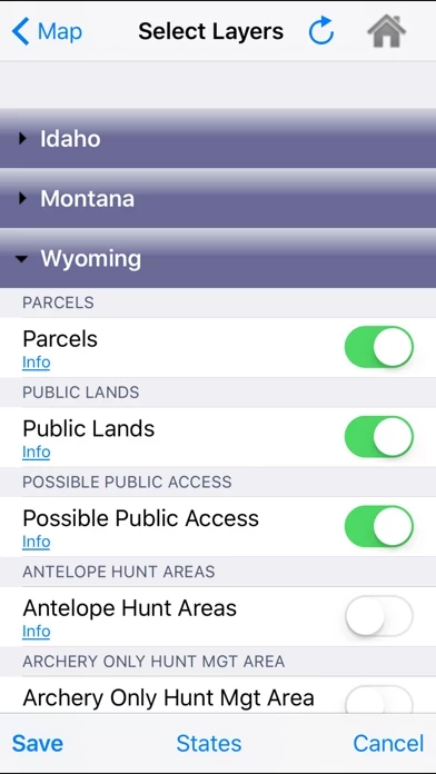
zones, restricted areas, possible access areas, state refgues and more.
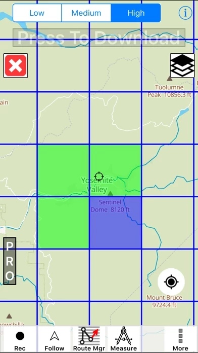
√ Vector USGS contours (Change height to ft or meter).
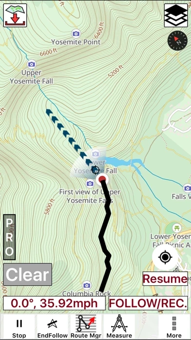
Captures d'écran officielles
Détails du produit et description de
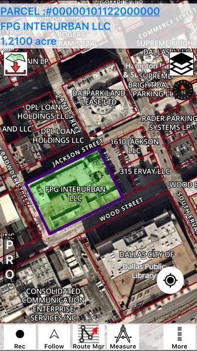
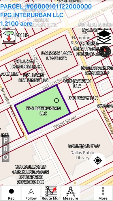
This hunting GPS app provides access to property line maps, parcels & public lands, land ownership details. Map layers for 50+ states include hunting zones, restricted areas, possible access areas, state refgues and more. Vector topo maps with most accurate USGS elevation contours, hiking & biking trails. Coverage includes all US states. ► Vector Topo Maps √ Beautiful & detailed Hardware/GPU accelerated vector maps (text stays upright on rotation) √ Vector USGS contours (Change height to ft or meter). √ Covers popular hiking & biking trails and paths ► Parcel Maps √ Includes following ownerhsip attributes (where available) * Owner name and Owner address * Site Address * Parcel ID Total Value ► Hunt Planning maps √ Possible Public Access √ Public lands and Parcels √ Hunting Zones √ Game Distribution √ Restricted Ares √ Portions ► Offline vector maps √ Easy to download offline topos ► PLSS maps √ PLSS Townships and Sections (US Wide coverage) ► Custom base maps √ Switch base maps between vector topos, hybrid satellite imagery and more ►GPS FEATURES √ Record Tracks √ Enter or import Waypoints. √ Auto Follow * Real Time Track Overlay * Predicted Path Vector * Course Up(Text stays upright) * Speed & Heading √ Route Assistance With Voice Prompts * Prompts when approaching a boating route marker * Continous distance & ETA updates * Alerts when off route * Alerts when moving in wrong direction ►ROUTE MANAGEMENT / TRIP PLANNING √ Create New Route/Edit Existing Routes √ Move Points √ Add points to an existing route leg √ Delete / Rename points √ Import GPX,KML & KMZ files √ Plot/Edit Routes √ Enter Waypoints √ Share/Export Routes,Tracks&Markers √ Reverse Routes ►Solunar Forecast * Sun Rise, Sun Set * Moon Rise, Moon Set, Moon Transit, Moon Phase * Major & Minor activity times * Day Scale ► SHARING * Share tracks/routes/markers on Facebook & Twitter * Export tracks/routes/markers as compressed GPX files.