Wildfire Info Übersicht
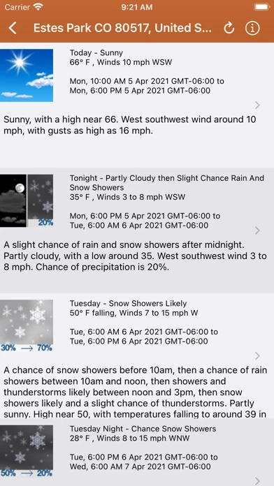
Lookup current weather conditions, including temperature, wind and gust conditions, and local forecasts anywhere in the USA using map quick lookup or search: Detailed NWS Forecast, Hourly Forecast, Grid Data Forecast, and Summary Forecast.
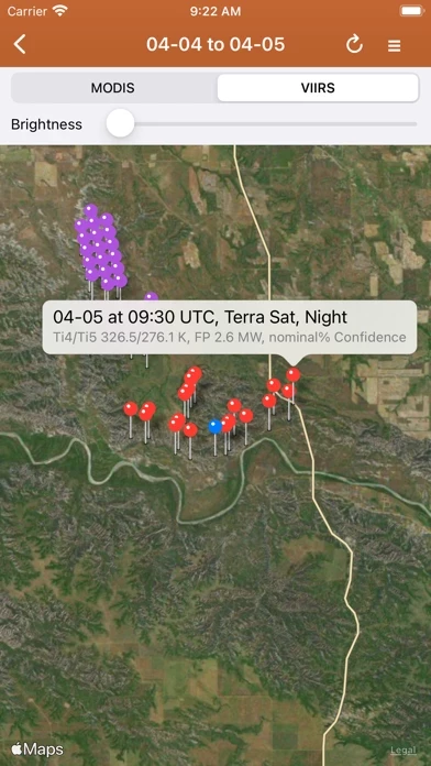
NASA MODIS and VIIRS satellite instruments: Thermal hotspot maps by region show wildfire activity in the past 48 hours.
Lookup a driving route to any fire or hotspot with Google or Apple Maps directions Universal Links.
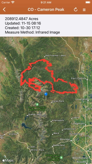
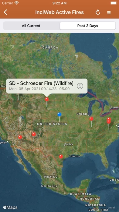
IRWIN Current Wildfire Perimeters (Integrated Reporting of Wildland Fire Information).
Offizielle Bildschirmfotos
Produkt einzelheiten und Beschreibung von
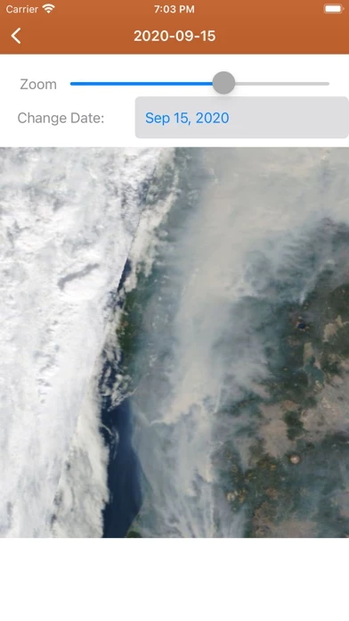
Browse current wildfire and prescribed burn activity throughout all of the world. NASA MODIS and VIIRS satellite instruments: Thermal hotspot maps by region show wildfire activity in the past 48 hours. See hotspot info including fire radiance power, brightness temperature, and confidence. IRWIN Current Wildfire Perimeters (Integrated Reporting of Wildland Fire Information). Tagged by state, search by name, and filter by acres burned. Lookup current weather conditions, including temperature, wind and gust conditions, and local forecasts anywhere in the USA using map quick lookup or search: Detailed NWS Forecast, Hourly Forecast, Grid Data Forecast, and Summary Forecast. View 250m resolution true color images from NASA GIBS (Global Imagery Browse Service). Images are available back to Jan. 1 2007. Worldwide coverage. InciWeb & CAL FIRE active fire maps: hotlink to the corresponding official incident webpage. CHP (California Highway Patrol): Incident in the past 3 hours related to fires are filtered out separately, all traffic incidents are included viewable by last 1 or 3 hours. An aggregated news wire service for wildfires: find mainstream media news quickly, past six hours of headlines and links. New wildfire Situation Reports section with PDFs from NIFC and more. Lookup a driving route to any fire or hotspot with Google or Apple Maps directions Universal Links. Save your preferred Directions Provider in the App Settings. There is a section for wildfire-related US government Twitter accounts viewable by map by approximate location or sorted into national and state sources in a table view. Information is posted as soon as it becomes available from IRWIN, NASA, InciWeb, CAL FIRE, CHP, NOAA, NWS. User-Submitted Map feature: if you see a wildfire or other large fire, you can report it here. Photos are allowed. Posts and replies are anonymous, no account needed. This app is not affiliated with any government agency. Terms of Use: https://davidgrossapps.com/terms/tos-wildfire-info.html