Wildfire Info Overview
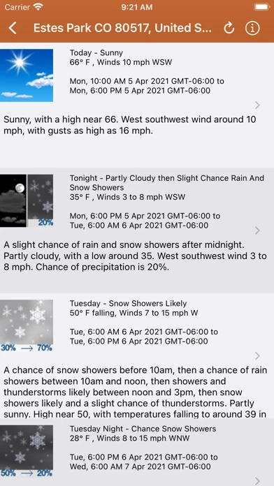
Lookup current weather conditions, including temperature, wind and gust conditions, and local forecasts anywhere in the USA using map quick lookup or search: Detailed NWS Forecast, Hourly Forecast, Grid Data Forecast, and Summary Forecast.
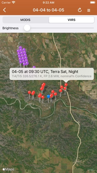
NASA MODIS and VIIRS satellite instruments: Thermal hotspot maps by region show wildfire activity in the past 48 hours.
Lookup a driving route to any fire or hotspot with Google or Apple Maps directions Universal Links.
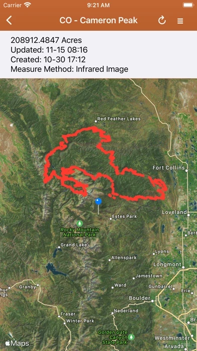
IRWIN Current Wildfire Perimeters (Integrated Reporting of Wildland Fire Information).
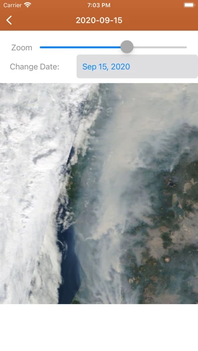
Official Screenshots
Product Details and Description of
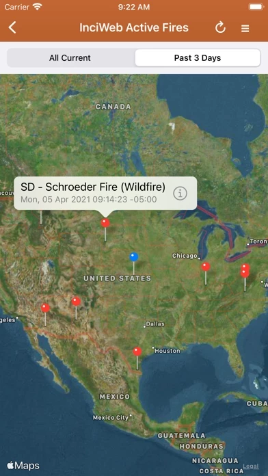
Browse current wildfire and prescribed burn activity throughout all of the world. Active Wildfire Perimeter full data from WFIGS and IRWIN updated every 20 minutes. Tagged by state, search by name, and filter by acres burned. WFIGS: Wildland Fire Interagency Geospatial Services (WFIGS) Group IRWIN: Integrated Reporting of Wildland Fire Information NASA MODIS and VIIRS satellite instruments: Thermal hotspot maps by region show wildfire activity in the past 48 hours. See hotspot info including fire radiance power, brightness temperature, and confidence. A Recent Wildfire News section: find news from 1,700+ cited sources quickly on a map or in a table view tagged by state alphabetically. Set up your own custom state feed with the state toggles. Quickly lookup new source homepages near specific fires. InciWeb & CAL FIRE active fire maps: hot-link to the corresponding official incident webpage. CHP (California Highway Patrol): Incidents in the past 3 hours related to fires are filtered out separately, all traffic incidents are included viewable by last 1 or 3 hours. Lookup current hyper-local weather conditions, including temperature, wind and gust conditions, and local forecasts anywhere in the USA, Canada, or Australia using map quick lookup or, for USA, search: Detailed NWS Forecast, Hourly Forecast, Grid Data Forecast, and Summary Forecast. Wildfire Situation Reports section with mirrored PDFs from NIFC and more. NESDIS GOES 16/17 satellite animation GeoColor and Fire Temperature quick links at relatively high resolution. Hourly air quality data maps from EPA AirNow: PM2.5, PM10, and Ozone. Color-coded to correspond to the common air quality index reference number (AQI). Map Measurement Tool added to the Map Tools Side Menu. Measure distance and area and save your measurements locally. If you delete the app, you will lose your measurements. A feature to backup your measurements to a .xml file is coming soon. Premium users: View 250m resolution true color images from NASA GIBS (Global Imagery Browse Service). Images are available back to Jan. 1 2007. Worldwide coverage. Premium Users: Lookup a driving route to any fire or hotspot with Google or Apple Maps directions Universal Links. Save your preferred Directions Provider in the App Settings. There is a section for wildfire-related US government Twitter accounts viewable by map by approximate location or sorted into national and state sources in a table view. User-Submitted Fire Map feature: map-based wildfire-related chatter. Photos are allowed. Posts and replies are anonymous; no account needed. Information is posted as soon as it becomes available from WFIGS, IRWIN, NIFC, NASA, InciWeb, CAL FIRE, CHP, NOAA, GOES/NESDIS, EPA, and NWS. This app is not affiliated with any government agency. Terms of Use: https://davidgrossapps.com/terms/tos-wildfire-info.html
Top Reviews
By SoCal Videohead
This is what professionals in California have nearby
First, to all the reviewers who don’t know, the ‘Cal’ in Cal Fire stands for California (formerly CDF or California Department of Forestry). This is your first stop for information on wildfires in California so that is where the priority information emphasis is The Cal Fire active fire map is your number one first stop to see the morning and evening report stats and assess each fire in the state. Having the Twitter feed included is golden. Those two features alone are worth having this in you pocket if you use them for work (as I do) could be threatened by an active fire or just want to know what’s going on. (Note - I write very few reviews and am not a Cal Fire employee, but my work puts me at many of the state's biggest wildfires)
By lars b amble
great app for what it does
who needs the hyperbolic news when you can just get actual fire data direct from reliable sources. love this app - especially when my mom texts from montana with whatever recent sensationalist nonsense the TV has had to say about fires here in california. 5 stars.
By CADreamer@thebeach
So far so good
Haven't had a chance to use it much yet but it has several sites with up to date information since it is pulling directly from the sources. Not a great interface but it does pull these sources together on one page.