
HiiKER: The Hiking Maps App Application Similaire
Dernière mise à jour le 2024-10-18 par Waymarked Trails LTD
Trouvez les meilleures applications comme les concurrents HiiKER: The Hiking Maps App, et les meilleures applications logicielles/SaaS
dans cette catégorie. HiiKER is the hiking app that is dedicated to building tools specifically for
the hiking community. More than just a map and a compass, the app enables you to
hike in the great outdoors with c...
46 Meilleures Application Comme HiiKER
Quels sont les meilleurs logiciels comme HiiKER: The Hiking Maps App pour 2025? Voici les logiciels Navigation les plus similaires que nous avons trouvés.

GoSkyWatch Planétarium
***** Comme on le voit dans l’évènement de l'iPad 2 d'Apple ***** Identifiez et localisez facilement et rapidement les étoiles, les planètes, les constellations, les galaxies, et plus en pointant simplement vers le ciel. Votre télescope personnel jusqu'aux merveilles dans le ciel nocturne...

iNavX - Marine Chartplotter
* Naviguez en toute confiance, naviguez avec iNavX : la première application de navigation maritime au monde
* Et c'est la SEULE application à fournir toutes vos cartes préférés de vos fournisseurs de cartes favoris, dont C-MAP!
« Le choix de l’éditeur » - Practical Sailor
« La référence » - Cruising Magazine
« Sur la liste des incontournables » - Cruising Magazine
Reconnue comme fiable à l'échelle interna...

TideApp
TideApp brings tidal charts and data right to your iPhone, now updated for iOS7 with an new interface, stability enhancements and more.
TideApp allows you to view the tide conditions near you or at over 4,000 locations worldwide...
Geocaching Toolkit iGCT
Geocaching is a worldwide game of hiding and seeking treasure.
A multi-cache involves two or more locations...

TrafficCamNZ Lite
TrafficCamNZ Lite gives you the power to load any Internet web camera that you want to look at. A default list of more than 50 cameras is provided, you can then find and add your own...

11880.com - Telefonbuch
Wenn Sie:
- Ihre Freizeit nicht lange im Voraus planen wollen,
- Ihre Stadt lieben und viel unterwegs sind,
- und einfach wissen müssen, was JETZT in Ihrer Gegend los ist,
dann ist unsere App die Richtige für Sie, denn die 11880.com ist mehr als nur eine Telefonauskunft...
Speedometer Speed Box App
Speed Box Free is a free speedometer, odometer and compass for the iPhone. Track your speed and distance from your iPhone!
* MPH, KM/H and KNOTS display
* 3 Beautiful Speedometers
* Digital Speedometer
* Distance
* Set distance to arbitrary value by tapping it
* Portrait and Landscape Mode
* For iPhone AND iPad
In addition you can get more features with the "Pro Pack":
* 10 designs
* Map View
* Compass display
* Maximum spee...

Mappy - GPS, trafic & prix
DECOUVREZ MAPPY – L'application GPS conçue et réalisée en France.
Mappy c'est l'application conçue et réalisée en France qui vous accompagne dans tous vos trajets au quotidien !
Découvrez dès à présent notre GPS Carplay...

Navigation Waze et trafic
Toujours savoir ce qui se passe sur la route avec Waze. Même si vous connaissez le chemin, Waze vous informe en temps réel de la circulation, des travaux, de la police, des accidents et plus...

Spyglass
Spyglass, boîte à outils GPS de navigation en plein air et tout terrain pour s'en servir comme de jumelles, viseur haute-technologie, boussole high-tech avec carte, compas gyroscopique, récepteur GPS, traceur de balisage, compteur de vitesse, altimètre, cadran solaire, détecteur de la lune et des étoiles, gyroscope d’horizon, télémètre, convertisseur de données, sextant, inclinomètre, calculatrice d’angle et app...

Coyote : Carplay, GPS & radar
Roulez en sécurité et gardez vos points avec les alertes et la navigation Coyote. PROFITEZ D'UN ESSAI GRATUIT ET SANS ENGAGEMENT...

Orlando Theme Park Day
Your handheld guide and planning tool for all of the Walt Disney World® Resort, Universal Orlando® Resort and SeaWorld® Orlando theme parks. Do more and wait less with preset and customized touring plans, wait times and easy access to all the details of your favorite attractions...

MVV-App
Die MVV-App ist die kostenlose und werbefreie App für Fahrplanauskünfte und HandyTickets des Münchner Verkehrs- und Tarifverbunds (MVV) für den ÖPNV in München und Umgebung.
Als hilfreicher Begleiter unterstützt Sie die MVV-App bei Ihrer Fahrt mit Regionalzug, S-Bahn, U-Bahn, Tram, ExpressBus, MetroBus, StadtBus, Regionalbus, RufBus oder RufTaxi im gesamten Verbundraum...

ATM Milano Official App
ATM Milano è l’unica applicazione ufficiale dell’Azienda Trasporti Milanesi S.p...

VRR App - Fahrplanauskunft
Von der Auskunft bis zum Ticket: Die VRR-App für deine Mobilität mit Bus und Bahn.
FUNKTIONEN und FEATURES
• Fahrplanauskunft
Wähle für deine Bus- und Bahn-Verbindung einfach deine Zielhaltestelle und die App zeigt die Abfahrts- bzw...

Citymapper
L'application de tous vos déplacements - trouvez le meilleur itinéraire sur tous les modes de transport à travers le monde !
Laissez-vous guider étape par étape sur tous vos trajets: en transports en commun, à vélo, en trottinette, et à pieds.
« L'application de transport la plus complète » - LCI
« Couteau-suisse de la mobilité » - Le Figaro
« Ne cherchez plus l’application miracle… Elle existe ! » - Franc...

Munich App
muenchen.de, the official city portal presents the Munich App with a lot of information and access to all important services of the city...

Île-de-France Mobilités
Rechargement de votre passe Navigo, itinéraires, horaires en temps réel, info trafic. Vianavigo évolue et devient Île-de-France Mobilités pour mieux vous accompagner au quotidien : train, RER, métro, tramway, bus, car, vélo, Vélib’, covoiturage, autopartage… Retrouvez les outils et informations essentiels à l’organisation de vos déplacements en Île-de-France...

Transit • Horaires Bus & Métro
Transit est le moyen le plus rapide de se déplacer en ville ! En un clin d'oeil, Transit vous affiche toutes les options de transport disponibles autour de vous ainsi que les prochains horaires de départ – accès instantané à l'information dont vous avez le plus besoin. Le bus a encore du retard ? Planifiez rapidement un nouveau trajet, commandez un Uber, ou prenez le vélo en libre-service le plus proche !
Transit fon...
Rother: Wandern & Karten
Die neue Rother Tourenapp: Einfache Routenplanung mit Premium-Karten und über 10.000 geprüften Touren von professionellen Wanderautoren...
Saarland: Touren - App
Vielfalt und Genuss wird im Saarland großgeschrieben. Wandern auf Premiumwegen, Genießen auf den Tafeltouren, Entschleunigen auf flussbegleitenden Radwegen oder Beschleunigen auf naturnahen Mountainbike-Trails...
Bonjour RATP
Bonjour RATP
DÉCOUVREZ BONJOUR RATP – Transports et mobilités à Paris et Île-de-France
Bonjour RATP c’est votre app qui enrichit votre expérience et simplifie tous vos déplacements quotidiens !
TOUS VOS ITINÉRAIRES DE TRANSPORTS À PORTÉE DE MAIN
Tous vos trajets et déplacements à Paris et IDF à portée de main : Bus, Metro, RER, Tramway, Transilien SNCF, Velib’, VTC Marcel, Trottinettes TIER ou encore Noctili...

Brandenburg App
DIE BRANDENBURG APP
Im wasserreichsten Urlaubsgebiet in Deutschland angekommen – und nun? Wenn du es leid bist, verwirrende Veranstaltungskalender und unzählige Seiten für Ausflugsziele zu durchforsten, dann haben wir etwas für dich: Mit der neuen Brandenburg App erlebst du mehr von Brandenburg.
Entdecke deine Umgebung
In der neuen Brandenburg App findest du so viele Möglichkeiten, deine Auszeit zu genießen – egal,...

Google Maps
Explorez le monde qui vous entoure rapidement et facilement avec Google Maps. Nous avons cartographié plus de 220 pays et territoires, et répertorié des centaines de millions d'établissements et de lieux sur la carte...
Essence / Gasoil Now
Proche de la panne d’essence ?
Essence / Gasoil Now, l’appli simple et efficace qui vous renseigne sur les stations essence les plus proches ou les moins chères du coin !
- Découvrez en direct les stations non épuisées avec les signalements de la communauté -
Fonctionne en France métropolitaine, en Espagne, en Italie et au Portugal basé sur les données officielles publiées par le gouvernement.
La Belgique, le ...
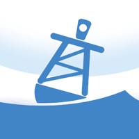
Buoyweather - Marine Forecasts
Buoyweather provides marine forecasts for offshore fishing and boating. Use Buoyweather to get all the information you need to enjoy your time on the water while staying safe and making sound decisions...

The SPOT App
SPOT satellite devices provide GPS location-based messaging, emergency, and coordination with Search and Rescue and anti-theft alerting and tracking beyond the boundaries of cellular. The SPOT satellite technology, powered by Globalstar, has initiated over 7,000 rescues around the globe...
Hot Météo Thermomètre
Avec cette application, le temps chaud thermomètre, vous pouvez vérifier à tout moment le temps et la température et les prévisions météorologiques pour les prochains jours. L'application fonctionne partout dans le monde...

neanderland STEIG Hiking App
This app is the perfect companion and tour planner for your hike on the neanderland STEIG. It contains all the important information about the route, restaurants and sights...
Grand Line - Record route and weather
Wherever you are, whenever you want, with this app, just move your finger and you can record the trifles such as weather, address, longitude and latitude. Or you can just check the information you want to know...

Osthessen-Blitzer
Die aktuellen Meldungen von Oshessen-blitzer.de jetzt direkt aufs Smartphone bekommen...
Aviation Weather Route Planner
Get all weather forecast and alternate airport data during your flight. This simple and useful application was developed for pilots to save time and get accurate weather data! Try this weather map now for free and explore the new features of the recently updated weather forecast app for pilots...
PredictWind Offshore Weather
Powered by PredictWind's world leading marine weather forecasts, the free offshore app allows seamless downloading of multiple GRIB files for your coastal or offshore passage. The intuitive interface allows you to download and immediately view GRIB files, weather routes, GMDSS Text forecasts and Satellite Imagery...
NOAA Buoys Live Marine Weather
Get real-time NOAA buoys marine weather data directly to your iPhone and iPad.
Search for weather buoys all over America and plan your sailing/fishing/surfing expedition!
- More than 2000 weather buoys available
- Check all the weather buoys from the map
- Search weather buoys by name, description, region, US state, or geolocation (latitude, longitude - GPS location service supported)
- Save your favorite weather buoys so t...

NOAA Aviation Live Sky Weather
Get real-time airport weather data NOAA/NWS/NEC/AWC directly to your iPhone and iPad.
Search for weather stations and airports all over the World...


Aviation Weather Group Manager
Thanks to everyone for making FlyGo-Aviation apps so successful, with over 100.000 downloads!
Create any groups related to your flights...

Radarbot: Détecteur de radar
La seule application avec alertes en temps réel et avertissements de radars hors ligne. Radarbot est une application unique et puissante : le meilleur dispositif de présence de radars, d'alertes de circulation en temps réel et de limites de vitesse pour voitures, motos, camions et utilitaires...
DaBus2 - The Oahu Bus App
No more getting caught in the rain waiting for the bus! No more scratching your head and wondering if you had missed the bus! No more guessing when the next bus will arrive.
The DaBus app takes the guesswork out of catching the bus on the island of Oahu...

Geovelo - GPS & Stats vélo
Geovelo, votre application gratuite GPS, vos statistiques et vos challenges !
• ITINÉRAIRES PERSONNALISÉS & GPS
L’application s’adapte à votre type de vélo (classique, assistance électrique (VAE), libre-service (VLS), à votre vitesse de déplacement et au type de parcours souhaité (du plus rapide au plus sécurisé). Geovelo choisit en priorité les pistes, bandes cyclables et rues peu passantes pour vous assure...

LUUP - RIDE YOUR CITY
FIRST TIME COUPON [NEWRIDE] FOR A FREE 30 MINUTE RIDE! *
*[NEWRIDE] Coupons are valid in: Tokyo, Osaka City, Kyoto City, Yokohama, Utsunomiya, Kobe, Nagoya, Hiroshima
Ride e-scooters/e-bikes at a discount!
"LUUP" is a sharing service that allows you to ride small e-bikes and e-scooters around town from anywhere and return them to the place you choiced. The service is currently available in Tokyo, Osaka, Kyoto, Yokohama, Uts...
Topo Map & Hiking Tracker
** The #1 Hiking Tracker App for iOS **
TRACK YOUR STATS!
+ Total distance
+ Total vertical
+ Total time
+ Calories burned
* Optimized to save battery life
VIEW YOUR TRACKS!
+ Recap your hike on the map
+ Color coded tracks based on relative elevation
+ Quickly view stats on Apple Watch display
+ iOS 14 home screen widget
BACKUP TO iCLOUD
+ Automatically backup data to iCloud
+ Share data between devices
THE BES...

myAtlante
myAtlante vous permet d'explorer les bornes de recharge Atlante dans toute l'Europe du Sud, facilitant ainsi la recharge de votre voiture électrique. Localisez facilement les stations de recharge, pour que votre véhicule électrique soit toujours prêt à prendre la route...
FakeGPS - Location Changer
The FakeGPS application acts as a digital illusionist, convincing your device it resides in a locale far from its true physical whereabouts. Employed for an array of reasons, from safeguarding one's digital footprints to bypassing geo-restrictive barriers, or even for app development and testing scenarios, this software enables users to navigate the globe virtually...


