OvitalMap Erfahrungen und Bewertung
Veröffentlicht von Beijing Ovital Software Co.,Ltd. on 2020-05-19🏷️ Über: OvitalMap is a map browser developed by Beijing Ovital Software Co.,Ltd.

🏷️ Über: OvitalMap is a map browser developed by Beijing Ovital Software Co.,Ltd.


Plus: Viele verschiedene Ansichten, die auch funktionieren.
Man kann Flächen definieren, um innerhalb dieser die Kartendaten fūr den offline- Zugriff zu speichern, Super!
Mein Wunsch: Import und Darstellung von gpx files, also gespeicherte tracks.
endlich eine app mit der man problemlos sat-karten speichern kann.
Worldwide promote your apps and rapidly increase downloads and revenue above 50 times! We are app marketing experts with rich experience, Please contact me at Skype/WhatsApp:
+8618228157920 .Everyone can enjoy 3-day trial now!
Ich hab ein I Phon und ich kann nich Unterlagen. Im welche Länder ist OvitalMap zugelassen?
OvitalMap ist sehr sicher in der Nutzung.
JustUseApp Sicherheits-Score für OvitalMap: 85.8/100.
Diese Einschätzung basiert auf unserer NLP-Analyse von 3 Nutzererfahrungen.
Zusätzlich zur durchschnittlichen Store-Bewertung von 5.0/5.
OvitalMap wirkt authentisch und seriös.
Unsere NLP-Modelle schätzen die Seriosität. JustUseApp Seriositäts-Score für OvitalMap: 155.4/100.
Dieses Fazit beruht auf der Analyse von 3 Nutzererfahrungen.
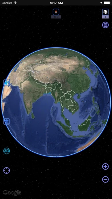
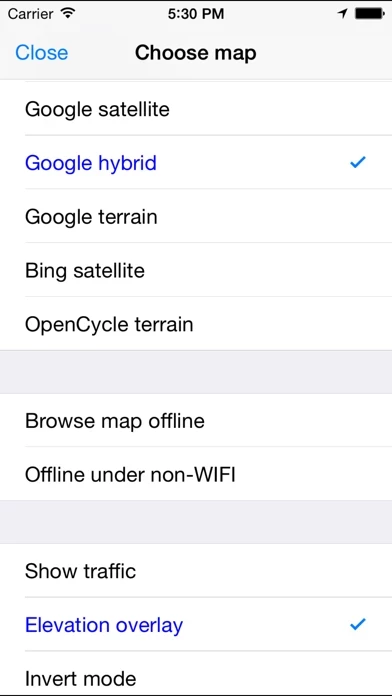
OvitalMap is a map browser developed by Beijing Ovital Software Co.,Ltd. based on Google API, supporting offline views of Google Map, satellite map and terrain map, as well as voice navigation.
The API search engine will offer information about your location, roads, and buses, as well as hotels, entertainment, banks, restaurants, supermarkets, gas stations, parking lots, and tourist attractions nearby a certain position.
When you are using the system to chat with a friend (just like using QQ or MSN), you can insert a location tag, travel solution, or a map created by yourself.
We also can direct output the contour line in 10 meters on the satellite map, which helps you directly see the elevation data on satellite map.
Elevation data service, the Cloud of Ovitalmap integrate SRTM3 elevation data around the world.