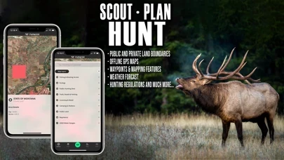
As a fully-enabled FREE GPS on mobile devices, users can turn their smartphones into the most accurate Offline location provider to view land ownership maps, hunting units with associated regulations and data, water bodies designated by fishing quality and rank, government recreational map layers, and much more.
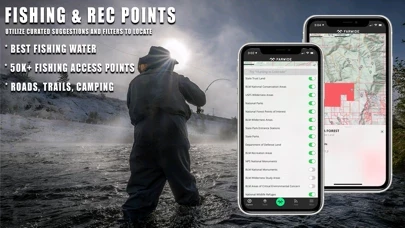
● Trailheads and trails, campsite locations, license agents, hunting check stations, shooting ranges, boat ramps, fish attractors, wildlife habitat, historical fires & timber harvests, GPS public hunting sites, fishing and boating access, hunting management zones, game migration zones and wintering.
FarWide brings the most relevant, and upgraded fishing, hunting, camping and outdoor recreation information and news to the palms of adventurous hunters, shooters, and fishermen, FREE of cost.
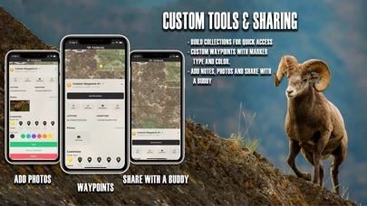
● Free of cost, customizable waypoints (by icon and color) to navigate back to your fishing access point, basecamp, or hunt stand.
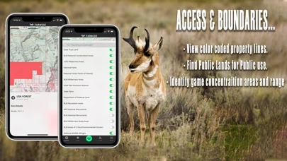
● Nationwide hunting and fishing access across public & private lands.