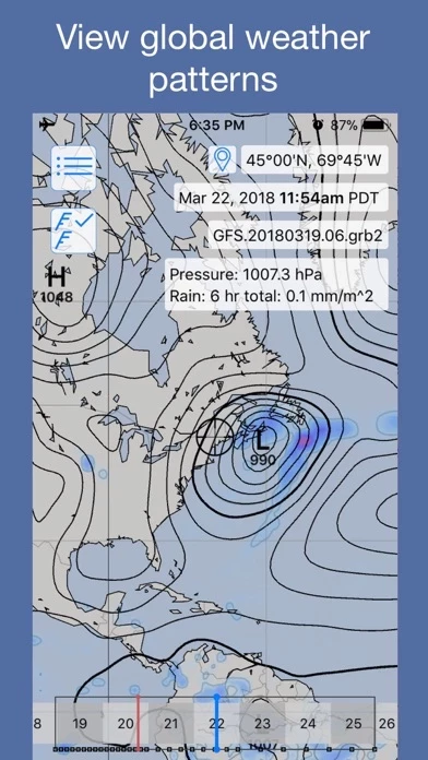
For meteorologists, and weather enthusiasts, LuckGrib offers access to a wide range of high resolutions models, a number of global models, weather data at the surface, 850mb, 500mb and 250mb levels, parameters ranging from simple things such as wind, pressure and temperature, to more advanced quantities such as simulated radar, standard deviations, precipitable water, lightning, vertical vorticity, helicity and more.
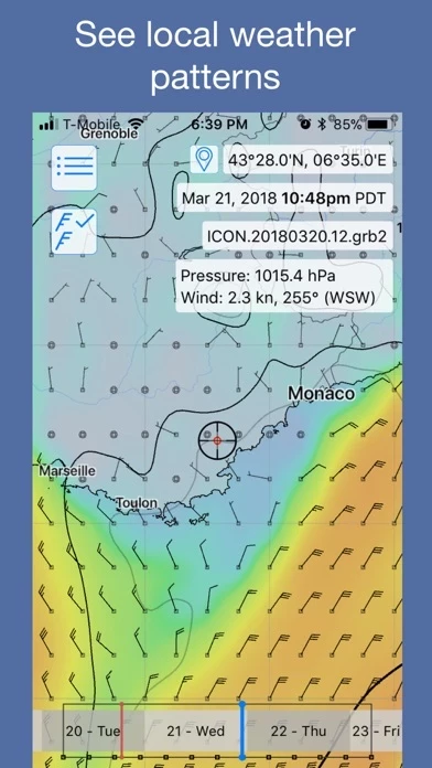
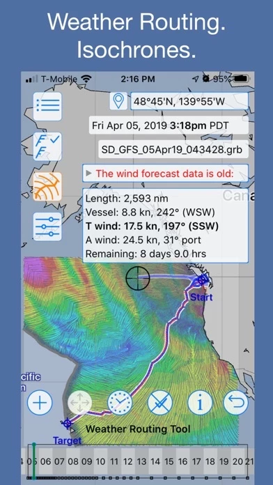
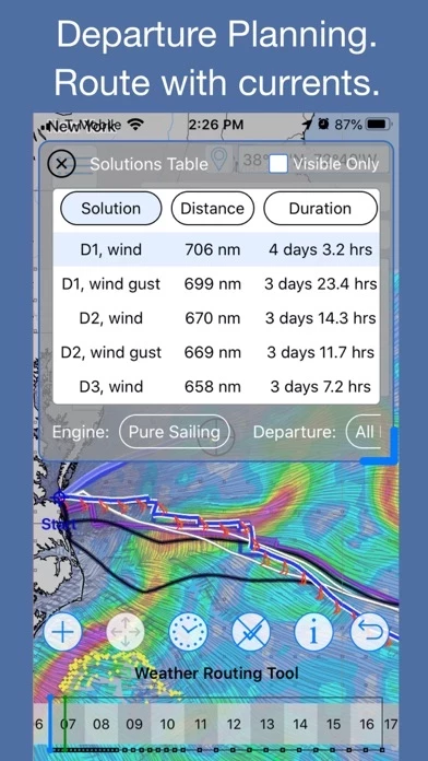
For offshore sailors, LuckGrib offers a best-in-class, complete solution: industry leading visualization and ease of use, highly optimized weather data downloads via satellite, along with industry leading optimized weather routing and route analysis.
LuckGrib provides access to many weather and ocean models, including: GFS, GFS Wave, GDPS/GEM, GEFS, HRRR, RAP, NAM, NBM, Icon-EU, Arpège, Arome, OpenWRF, RTOFS, NCOM and many others.
The LuckGrib isochronal Weather Routing solver is able to respect intermediate constraint points, the first in the industry.
The LuckGrib weather routing system is an industry leading, high quality, robust, high performance and comprehensive system.