OS Maps Übersicht
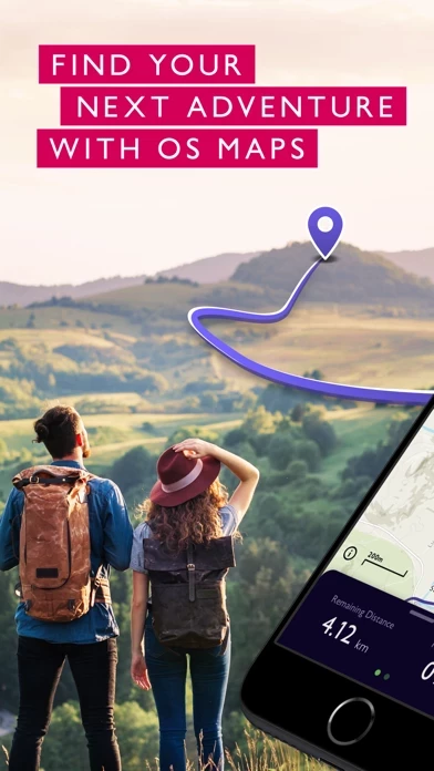
Looking to stay local? Or do you want to venture off the beaten track? Enjoy the fresh air, listen to the crunch of leaves under your feet and experience the enjoyment of finding a brand new route that you never even knew existed.
On desktop, premium users can use our 3D Aerial Layer to see the route terrain, explore in stunning 3D and print maps.
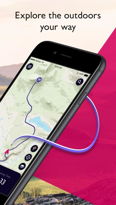
Whether you want to walk, cycle, hike, run or ramble, OS Maps will guide you through stunning routes across Great Britain.
Explore the great outdoors the way you want, all while staying safe with OS Maps - GB’s most popular leisure mapping app.
OS Maps was voted Yahoo Sports Technology Awards Best App, Outdoor Industry Awards Digital Product of the Year and Singletrack Best Online Service.
Battery life while using the app can be extended downloading maps offline prior to use, operating in Flight Mode (the GPS will still work) and turning off the screen when not in use.
Subscribe to unlock the detail and accuracy of OS leisure maps across the whole country including OS Explorer 1: 25,000 and OS Landranger 1:50,000 maps.
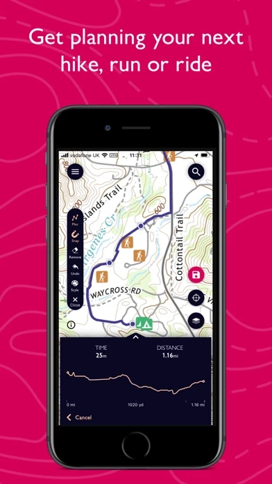
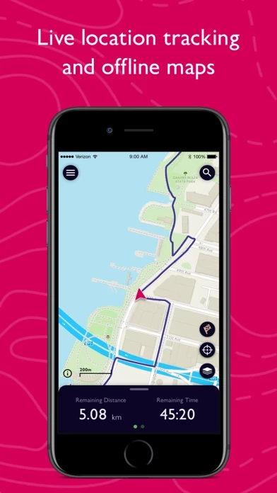
Use OS Maps as your off-road sat nav with automatic ‘snap-to-path’ giving you the most enjoyable and safe route between two points in National Parks.
Search for the best routes in an area as rated by fellow outdoor enthusiasts and plot your own route to follow, share or record.
Offizielle Bildschirmfotos

OS Maps Preis pläne
| Dauer | Betrag (USD) |
|---|---|
| Monatsabonnement | $7.00 |
| Jahresabonnement | $28.99 |
**Die Preisdaten basieren auf durchschnittlichen Abonnementpreisen, die von Justuseapp.com-Benutzern gemeldet wurden..
Produkt einzelheiten und Beschreibung von
Explore the great outdoors the way you want, all while staying safe with OS Maps - GB’s most popular leisure mapping app. Whether you want to walk, hike, run or ride, OS Maps will guide you through stunning routes across the UK. Looking to stay local? Or do you want to venture off the beaten track? Explore Great Britain & Northern Ireland, discover hidden gems & enjoy finding new routes that you never even knew existed. Why you’ll love using OS Maps: • ICONIC OS MAPPING Subscribe to unlock the detail & accuracy of OS leisure maps across the whole country including OS Explorer 1:25,000 & OS Landranger 1:50,000 maps. • EXPLORE READY MADE ROUTES Discover curated routes from expert outdoor organisations such as BBC Countryfile, Country Walking, Mountain Bike UK, Trail, AA Walks & more. • THOUSANDS OF ROUTES AT YOUR FINGERTIPS Search for the best routes in an area as rated by fellow outdoor enthusiasts OR plot your own route to follow, share & record. • TRACK & RECORD ACTIVITIES Use the activity recording feature to keep a log of your activity history. Follow along, save your activity, review it & turn it into a new route to share & follow again later. • AWARD-WINNING TECHNOLOGY OS Maps was voted Yahoo Sports Technology Awards Best App, Outdoor Industry Awards Digital Product of the Year & Singletrack Best Online Service. • USE ON EVERY DEVICE Sync your activities between desktop & mobile. On desktop, premium users can use our 3D Aerial Layer to see the route terrain, explore in stunning 3D & print maps. • APPLE WATCH COMPATIBLE Use the OS Maps companion app with your Apple Watch, to record your activity from your wrist & keep an eye on your progress whilst keeping your phone in your pocket. • NATIONAL PARK TRAILS Use OS Maps as your off-road sat nav with automatic ‘snap-to-path’ giving you the most enjoyable & safe route between two points in National Parks. • VIEW MAPS OFFLINE Download your favourite areas to view offline – so you can view any part of GB even without signal. Plus, you can export your favourite routes to your GPX device. • UNLIMITED PRINTING Print copies of routes & maps to take with you so you always have a backup. • AUGMENTED REALITY Pan the landscape to see what’s nearby including hills & mountains, forest & woodland, transport, settlements, coast & water. And, with one click, find local area information with routes, places to stay & local images. • TABLETOP 3D Preview a route before you tackle it, ensure it’s suitable for your level of fitness & avoid any scary drops. Our 3D model feature lets you check out your routes on top of your very own coffee table! SUBSCRIPTION INFORMATION OS Maps Premium is available through a 1 month or 1 year subscription. Prices are posted in GBP but may vary by country or when converted to local currency. Subscriptions will auto-renew. Payment will be charged to iTunes Account at confirmation of purchase. The subscription automatically renews unless auto-renew is turned off at least 24-hours before the end of the current period. Your account will be charged for renewal within 24-hours prior to the end of the current period, & identify the cost of the renewal. Subscriptions may be managed by the user & auto-renewal may be turned off by going to the user's Account Settings after purchase. Terms & Conditions at os.uk/termsosmaps USEFUL INFORMATION Battery life while using the app can be extended downloading maps offline prior to use, operating in Flight Mode (the GPS will still work) & turning off the screen when not in use. We release updates to all of our apps as we improve them, making them even more stable & adding extra features. Topographic mapping is available for UK (including Northern Ireland), USA, Australia & New Zealand. Your feedback & comments about this app are really important to us. Leave a review or use os.uk/contact to get in touch. *This feature uses Apple's ARKit which requires an iPhone 6s, iPhone SE, iPad 2017, iPad Pro or any later device.
Oben Erfahrungen und Bewertung
durch wunderkind
No recommendation!!
Tries two Premium Trials available only because I paid premium, both not up to date and led us in dead ends. The app feels like year 2000, compass not working and downloaded trails have not been available. This app does not work if you do not have internet!!!
durch Paul329876
Needs work to be done.
Works alright but only that. By far not as good and convenient as the Mapfinder app. Accuracy and detail of the maps are poorer. Only works with an image of a map. If you get closer, resolution gets poorer. Current location dot does not show direction of heading. I wished OS still suported Mapfinder rather than Maps. Wrong decision.