GPS WIZ Erfahrungen und Bewertung

GPS WIZ Erfahrungen und Bewertung

Veröffentlicht von on 2021-12-30

🏷️ Über: Upgraded World Magnetic Model for magnetic headings. New Search capabilities have been added with calculated automobile and walking directions based on available roads.


Lesen Sie 0 Kundenservice Bewertungen 👿🤬😡😠💢😤


Wie war Ihre Erfahrung mit GPS WIZ? Schreiben Sie eine Rezension


Funktionen

This is a very powerful map tool which lets you accurately measure distances, remember locations, get magnetic headings between selected points and much more.

The 2015 World Magnetic Model is a joint product of the United States National Geospatial-Intelligence Agency (NGA) and the United Kingdom’s Defence Geographic Centre (DGC).

A pin drop feature lets you measure distances from your current location to where you drop pin 1 and the distance between pin 1 and pin 2 so you can measure interesting map features quite accurately.

The total route distance will be calculated and shown automatically but you also have the ability to measure each leg distance and leg heading (in degrees true and degrees magnetic) by simply pressing the Leg button.

Placing pin 1 on a point of interest (e.g. airport) then moving the map to another point of interest (e.g. another airport) gives you the distance and bearing between these points.

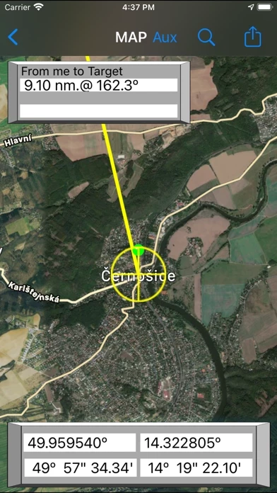
By placing the target on any point of interest, you automatically get a distance and bearing to that point from your current location.

This is a powerful feature for pilots to determine takeoff and landing distances on remote airports, grass strips and lakes for floatplanes.

The World Magnetic Model (WMM) is used to calculate magnetic declination and magnetic bearing.

A wide variety of users from builders, architects, pilots and boaters to crane operators will find this feature very useful.

Both distance and magnetic bearing are displayed.

Create routes with your own waypoints in a Route table, either directly from the map or selected from your saved sites, also with custom names if desired.

Upgraded World Magnetic Model for magnetic headings.

Pan and zoom on the map to locate and display your coordinates in both decimal degrees and degree minute second formats.

True bearing is calculated from spherical geometry using latitudes and longitudes.

  Kundenservice und Unterstützung
Entwickler:
Digilog Corporation