MapPath Übersicht
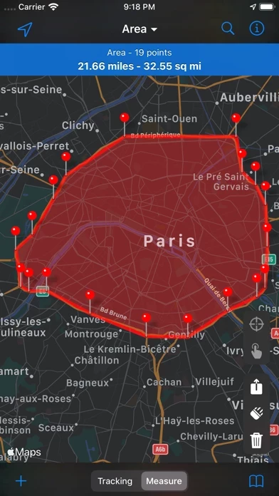
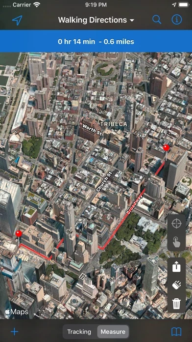
MapPath is also an utility that allows you to establish directions, measure distances, surface areas and perimeters by dragging pins (points) on the map.
Offizielle Bildschirmfotos


Produkt einzelheiten und Beschreibung von
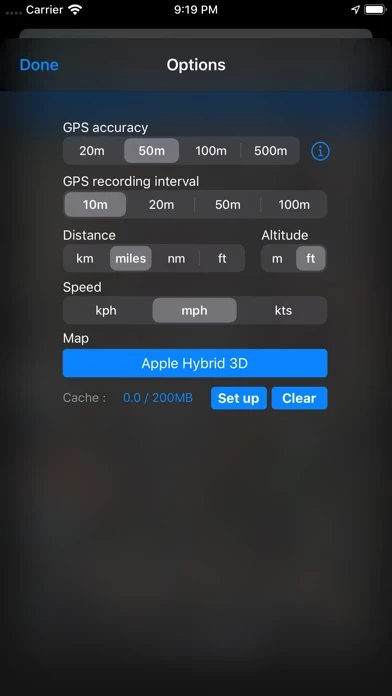
***** STANDARD VERSION ***** This version of diese App has 2 restrictions : - you can not record a trip more than a minute - you can not add more than 4 points in your measures The PRO version has no restrictions. ***** STANDARD VERSION ***** diese App is an easy-to-use app allowing you to record your trips. It displays your track, your position and live information such as your speed, altitude or average speed. diese App is also an utility that allows you to establish directions, measure distances, surface areas and perimeters by dragging pins (points) on the map. # GPS Tracker Features : - record your run: time, distance, altitude, speed, average speed - pause and resume recording as needed - display your track on the map - display charts of your altitude, speed and pace - location and heading tracking - cut portion of the track - display simultaneously several tracks on the map - change color of each track on the map # Measures Features : - directions up to 30 steps - measure distances, surface areas and perimeters using pins (points) on the map - add point to your measure by taping and holding the map - display simultaneously several measures on the map - change color of each measure on the map # Import / Export Features : - import and export tracks and measures as KML, KMZ, ITN, GPX and CSV files # Options : - gps accuracy options - system of units options - map types selection : Apple standard & satellite (3D) maps, OpenStreetMap, OpenSeaMap & custom maps # And also : - Dark Mode on iOS 13 - Split View and Slide Over multitasking on iPad - Widget displaying informations about your current location or current tracking diese App use iCloud to automatically keep in sync your tracks and measures across your devices. If you have any problem, suggestion, please feel free to contact me at [email protected] Note that continued use of GPS running in the background can dramatically decrease battery life.
Oben Erfahrungen und Bewertung
durch Andreas vdL
Gut für Messungen und Tracking
Nutze die App seit 2-3 Jahren und bin sehr zufrieden. Die aktuelle Version lädt unter iOS9 leider die OSM-Karten nicht mehr. In einer früheren Version wurde ab einer gewissen Zoomstufe das Satellitenbild eingeblendet, was zur Beurteilung von Wegen bei der Planung längerer Radtouren sehr gut war. Die Exportfunktionen sind mittlerweile sehr umfangreich. Weiter so!