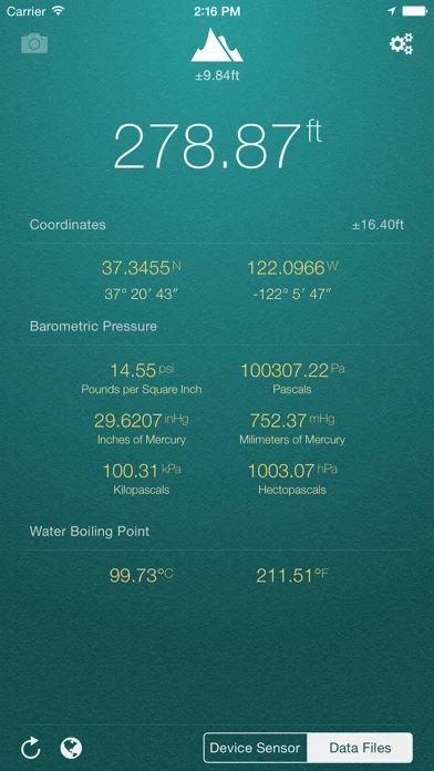
My Altitude uses GPS signals to determine your current location, showing your latitude, longitude and altitude (height from sea level) barometric pressure and water boiling point.
By default, it uses device sensor to determine the elevation from see level, but you also have the option to use NOAA data files to get the altitude of your location.
On newer devices such as iPhone 6/6+ value is being delivered directly from device built-in barometric sensor, this behavior is configurable and you can switch back to calculation mode.
Picture will be sealed with coordinates of current location along with altitude and local date/time.
On newer devices, using device sensor is more accurate.