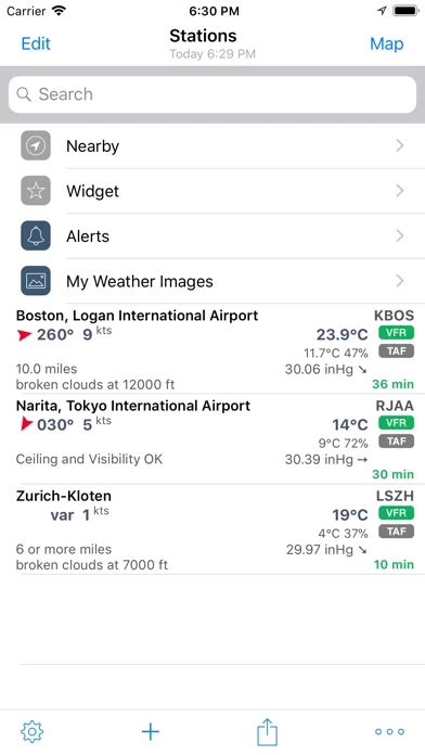
Define multiple alerts for each station with the following criteria: flight rule (US NOAA), wind speed, temperature, pressure, present weather, visibility, and ceiling (BKN and OVC).
AeroWeather Lite is helpful for weather preflight-briefings, but also to just get very precise weather.
METAR/TAF data comes primarily from a certified ANSP (air navigation service provider) and is provided reliably and fast from our dedicated, redundant servers (indicated by blue checkmark underneath METAR/TAF).
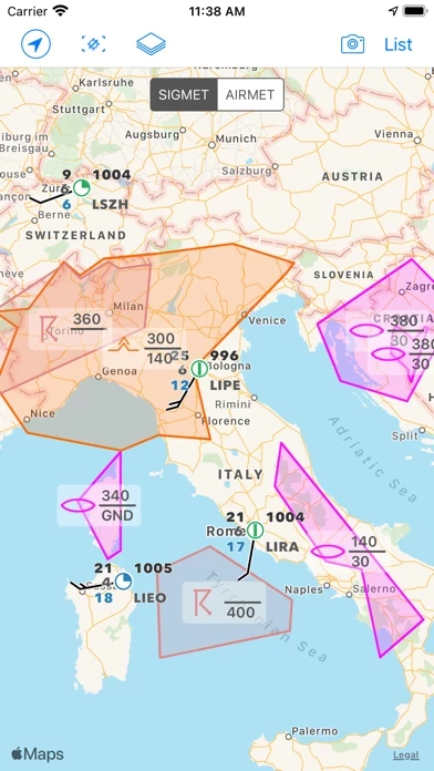
AeroWeather Lite offers built-in groups for nearby stations, today widget (pre iOS 14), and earthquakes.
In order to keep AeroWeather Lite free we added a small ad banner at the bottom of the screen.
AeroWeather Lite provides quick and intuitive access to METAR and TAF for airports worldwide.
The AeroPix feature offers users the possibility to take quickly picture(s) of the weather at their current location.
The app features a built-in airport database, which includes basic airport data like sunrise/sunset, twilight times, timezones etc.
Consider getting AeroWeather Pro, subscribe the additional features**, or remove the ad banner through one-time unlock* to have an ad-free app.
The pictures will be available to all other pilots (on the map or within an airport detail view) helping them to get a better idea about local conditions.
The subscription is valid in both AeroWeather Lite and Pro.
Additional features which generate recurring operation costs for us will be offered within a subscription.
*** Current and precise weather conditions (METAR) and forecasts (TAF).
There's also an iMessage app included which lets you easily send METAR/TAF of any airport to other users.