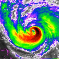
- 1-km high resolution cloudy-sky images for U.S., Japan, and Australia
- 4-km cloud-sky images for Europe and Russia
- Current weather details and ten-day forecast in pop-up window
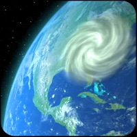
- Storm/hurricane/typhoon tracker and projected paths (International and Global)
- Two different layers to get the weather: ground stations, satellite
- Zoom in and out, drag and scroll
- Play, pause animations at any zoom level
- Displays current position on the map
- Saves and restores your last position
- Adjustable radar image quality for Wi-Fi and cellular connections
- Faster even when on 3G or EDGE networks
- Multiple map styles - terrain, satellite, or standard
- Full 64-bit app
- Requires any iPhone, iPad, or iPod
- Satellite data comes from GOES 13, GOES 15, METEOSAT, and MTSAT satellites
- Radar images delayed up to 30 minutes for the U.S, Japan, Indonesia, and Australia
- Radar images delayed up to 1 hour for Europe.