FarOut Guides Software
Company Name: Atlas Guides LLC
About: Atlas Guides, an online lead-generation solutions provider, published online directories that
focused on the financial services industry.
Headquarters: Bend, Oregon, United States.
FarOut Guides Overview
What is FarOut Guides?
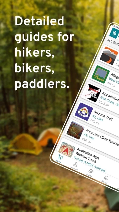
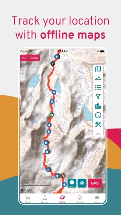
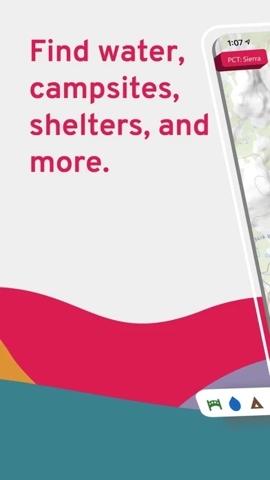
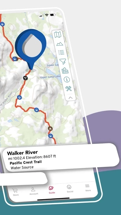
FarOut (formerly Guthook Guides) is a popular app for long-distance hiking, biking, and paddling. It offers over 100 trail guides around the world and allows users to stay connected with their friends and family through the Check-in feature. The app works completely offline and uses the mobile device's internal GPS to display the user's location and guide them along the trail.
Features
- Works offline: no data or internet required after initial setup
- Detailed waypoints and town resupply guides
- Keep friends and family up to date by checking in and sharing location
- Detailed offline maps including GPS location, detailed routes, and waypoints
- Elevation profile view to see when the next big climb is
- Create custom routes and waypoints to plan trips
- Real-time waypoint comments from other hikers, bikers, and paddlers
- Waypoints include water sources, shelters, campsites, road crossings, trailheads, junctions, viewpoints, peaks, parking, and many others
- Town guides include accommodation, restaurants, resupply, laundry, post offices, shops, historical sites, and more
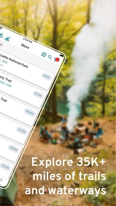
- Covers United States National Scenic Trails, United States Regional Trails, United States Trail Networks, Canada, New Zealand, Australia Hiking, Australia Cycling, UK & Europe, Middle East, and South America.
Official Screenshots
Product Details and Description of
FarOut (formerly Guthook Guides) is the most popular app for long-distance hiking, biking, and paddling. Explore 100+ trail guides around the world while staying connected to your friends & family back home with our Check-in feature. WORKS COMPLETELY OFFLINE Each guide works completely offline, even in airplane mode. It uses your mobile device's internal GPS to display your location and guide you along the trail no matter where you are. Whether you go on a day hike, section hike, or thru hike, FarOut will help you find your way. The majority of thru-hikers use our app on America's Triple Crown trails which include the Appalachian Trail, Pacific Crest Trail, and Continental Divide Trail. FAMILY AND FRIENDS CAN FOLLOW YOUR ADVENTURE Invite friends and family to follow you on your adventure. Drop Check-ins along the trail and leave updates to let your followers know you're safe. Adjust your privacy settings, approve followers, find friends to follow, and manage check-ins in the Social menu. TRUSTED DATA FarOut has your adventure covered with detailed maps showing your exact GPS location, detailed trails, and useful waypoints. All of our data is collected by trusted individuals and partners, and is kept up to date. KEY FEATURES -Works offline: no data or internet required after initial setup -Detailed waypoints and town resupply guides -Keep your friends and family up to date by checking in and sharing your location -Detailed offline maps including GPS location, detailed routes, and waypoints -Elevation profile view to see when your next big climb is -Create your own custom route and waypoints to plan your trip -Stay informed by reading real-time waypoint comments from other hikers, bikers, and paddlers DETAILED WAYPOINTS AND TOWN GUIDES -Waypoints include: water sources, shelters, campsites, road crossings, trailheads, junctions, viewpoints, peaks, parking, and many others -Town guides include: accommodation, restaurants, resupply, laundry, post offices, shops, historical sites, and more UNITED STATES NATIONAL SCENIC TRAILS: Appalachian Trail Arizona Trail Continental Divide Trail Florida Trail Ice Age Trail New England Trail Pacific Crest Trail Pacific Northwest Trail UNITED STATES REGIONAL TRAILS: Allegheny Trail Benton MacKaye Trail Buckeye Trail Buffalo River Trail The Colorado Trail Eagle Rock Loop Grafton Loop Trail International Appalachian Trail John Muir Trail The Long Trail Lost Coast Trail Mid State Trail Monadnock-Sunapee Greenway Mount Whitney Trail Ocean to Lake Trail Ouachita Trail Ozark Highlands Trail Pinhoti Trail Tahoe Rim Trail Tully Trail Wonderland Trail UNITED STATES TRAIL NETWORKS: Acadia National Park Baxter State Park Camden Hills Camel's Cutler Coast Donnell Pond Public Reserved Land Glastenbury & Bald Mountain Gulf Hagas Killington & Pico Maine High Peaks Mahoosuc Range Monadnock State Park Mount Mansfield Mount Sunapee Pillsbury State Park Pinnacle Mountain State Park San Jacinto Mountains Stratton Mountain Tumbledown & Little Jackson White Mountain National Forest Worcester Range CANADA: Great Divide Trail International Appalachian Trail NEW ZEALAND: Te Araroa Greenstone & Caples Track Kepler Track Milford Track Routeburn Track AUSTRALIA HIKING: Australian Alps Walking Track Bibbulmun Track Cape to Cape George Bass Coastal Walk Heysen Trail Larapinta Trail Overland Track South Coast and Port Davey Track Three Capes Track Walk the Yorke Wilson's Promontory Grand Circuit AUSTRALIA CYCLING: Dozens of long-distance routes and Rails to Trails routes across the entire country UK & EUROPE: Camino Frances / Camino de Santiago Camino Finisterre Camino del Norte Croatian Long Distance Trail Coast to Coast, Wainwright's Cotswold Way Hadrian's Wall Path The Ridgeway South Downs Way Tour du Mont Blanc West Highland Way MIDDLE EAST: Israel National Trail Jordan Trail SOUTH AMERICA: Torres del Paine, O & W Circuits (Chile) SUPPORT If you have any questions, email us at support@this app.com
Top Reviews
By Linuxian
Awesome Waypoint Feature Update
Guthook has been my go-to app for AT hiking since day one!!! I even carry the printed guide as backup for the phone. I opened the app for the first time in a while for my next hike and was very pleased to see such a useful feature update in an already amazing app. The only thing I would ask for is it would be nice to be able to display distances between waypoints with the starting waypoint set to zero. See, I use routes to plan the section and waypoints to break the section up into daily goals. It would be very useful to surface data on my progress through the day. I know I could create a whole new route for each day of the hike but this makes it more difficult to see the big picture of overall progress. It would be great to see the overall section broken down into easy to view daily goals in a similar way as the full route. Kinda like, mini or, sub-routes.
By tabasco.hikes
AT Thru-Hike (2015)
I thru-hiked the AT in 2015 which turned out to be the most amazing experience of my life and I did it with the Guthook App. I cannot recommend it enough for anyone planning to thru, section, or simply car camp the Appalachian trail. In my opinion, this goes on the list of "Don't leave home without it." The AT, at least when I hiked it, was 2,189.2 miles from Springer to Katahdin. Frankly, if you get lost on the AT, you probably don't belong there. So the value of the Guthook App isn't navigation. The reasons I found it to be most useful was to alert me to the elevation that was ahead, distance to shelters and water sources, and road crossings that would take me into trail towns to resupply. I used the Guthook App daily, but I also took along the AWOL AT Guide. I used this to a lesser extent, but I found it equally important. The AWOL guide is an invaluable resource for services along the trail (e.g., shuttles) and in trail towns (e.g., Post Office hours, lodging, etc.) I hope this helps and best wishes on your hike. "Today I begin a new trail in my life. A fresh start. A new beginning. Today I step off the rock at Springer to be transformed because I trust that it is only impossible dreams of this magnitude that will give birth to the type of change I covet." (April 1, 2015) Tabasco
By Captain Kneemo
Outstanding App
Outstanding is the word for Guthook! The support team is also beyond question, they were exceptional! I started my (eventually failed) thru hike without Guthook. Everyone that I met on the AT—-both thru and section hikers—had the app! During my first “zero” in a hotel with good WiFi, I purchased and downloaded it. Back on trail, it was a night and day difference. It eliminated so much of the mystery that challenges thru hikers initially! Best resupply, water sources, etc. I still carried my AWOL...and used it at night to conserve battery power...but once on Trail, I referred exclusively to “the Hook”! And the value of the interactive comments from other hikers cannot be discounted! This year, I hope to get back on the AT.... I also find the Guthook a great planning tool.