- Official Flood Warnings & other alerts from the National Weather Service
- River stage height in Feet
- River flow rate in CFS (when available)
- Indications that a river is at or approaching flood stage
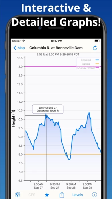
- Current observations and recent history
- NOAA river forecasts (when available)
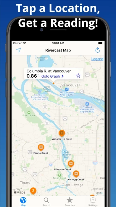
- Map interface that shows where river gauges are located geographically
- Search interface to find river gauges by waterway name, state, or NOAA 5 digit station ID
- Interactive graphs that can be zoomed in, zoomed out, or panned
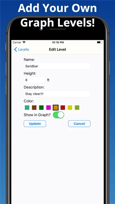
- Customizable graphs by adding river levels that are relevant to the user
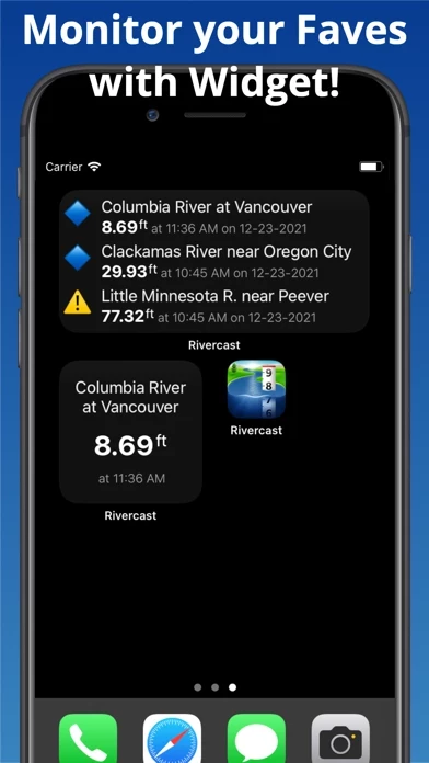
- Favorites list for locations that the user cares about the most
- Shareable graphs via iMessage, Email, Facebook, or Twitter
- Widget to monitor favorite locations at any time
- Color-coded map that indicates whether the location is at normal levels, approaching flood levels, or above flood stage
- Latest observations from the map, search, or favorites
- Detailed interactive hydrograph that can be accessed with an additional tap
- Ability to add own level lines to customize graphs
- Uses the latest observation and forecast data available
- Requires an Internet connection for use
- Favorites, Map "Instant Observations", and Hydrograph data is viewable in feet or cfs (when available)
- All observation and forecast data is in the user's local time
- USA-only river gauges reported
- Uses NOAA and AHPS for its raw data for custom graphing and mapping solutions
- Variances in CFS data may sometimes occur due to using different data models
- NOAA issues forecasts for many, but not all, rivers it monitors
- River gauges occasionally have technical problems transmitting their data or can get washed out during extreme flooding
- Includes all stations that NOAA provides for public use.