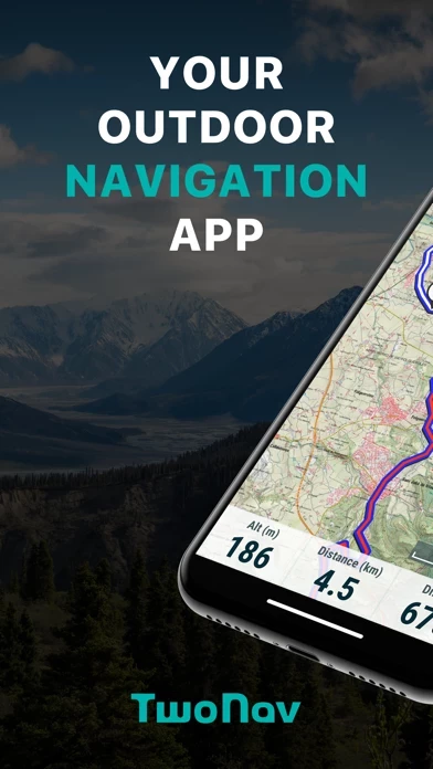
TwoNav: Maps Routes Software
Company Name: CompeGPS
About: Map viewing and GPS data software
Headquarters: Barcelona, Catalonia, Spain.
TwoNav Overview
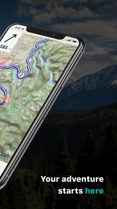
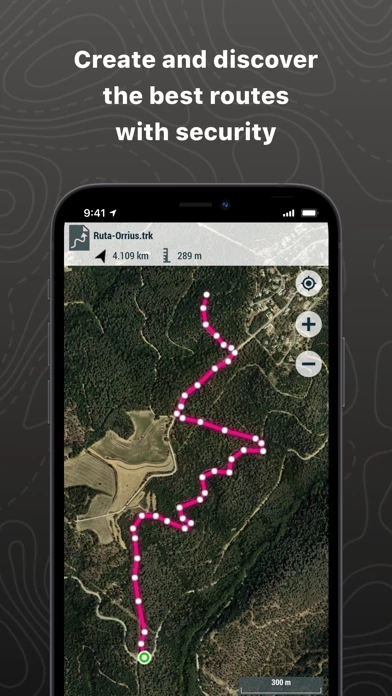
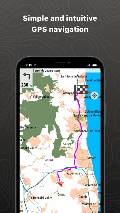
What is TwoNav? The TwoNav app turns your smartphone into a powerful navigation system for outdoor activities. It offers customizable features for different sports, safe exploration, simple and intuitive GPS navigation, training tools, route and waypoint creation, performance optimization, visible and audible alarms, live location sharing, detailed route analysis, and cloud connectivity. The premium version offers additional features such as open online maps, unlimited tracks and waypoint files, customizable data fields and alarms, advanced map exploration tools, and route creation.
Features
- Customizable features for different sports
- Safe exploration with route tracking and notifications
- Simple and intuitive GPS navigation with turn-by-turn directions
- Training tools for time, distance, and performance improvement
- Route and waypoint creation with photo and video integration
- Performance optimization with relevant data tracking
- Visible and audible alarms for safety and performance limits
- Live location sharing with Amigos™
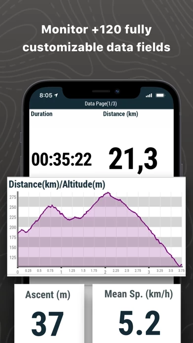
- Detailed route analysis with graphs and data fields
- Cloud connectivity with GO Cloud and other services such as Strava and TrainingPeaks
- Premium version with additional features such as open online maps, unlimited tracks and waypoint files, customizable data fields and alarms, advanced map exploration tools, and route creation.
Official Screenshots
Product Details and Description of
TURN YOUR SMARTPHONE INTO A POWERFUL NAVIGATION SYSTEM Explore your environment with the best maps, travel the most spectacular routes, improve your performance and, above all, practice your outdoor activities in complete safety. Take your outings to a new level. _______________________ ADAPT THE APP TO YOUR SPORT this app can be adapted to different sports, such as hiking, cycling, motor sports, flying, water sports... Create your profile and the app will adapts its configuration to this sport. Do you practice other sports? Create different profiles. _______________________ SAFE EXPLORATION Follow your route and keep under control the distance, time and ascent to reach your goal. Explore routes created by you, downloaded or calculate your route automatically. The App will notify if you deviate from tour course or if you run into something unforeseen. _______________________ SIMPLE AND INTUITIVE GPS NAVIGATION Forget the old roadbooks on paper. Your roadbook is now digital, everything you need to know is on the screen of your smartphone. The Aapp tells you turn by turn which road to follow. _______________________ TRAINING TOOLS You decide whether you train by time, by distance... or compete against yourself with TrackAttack™. Improve your performance from a previous training session. The app tells you whether you exceed your previous performance or whether you need to improve. _______________________ CREATE YOUR OWN ROUTES AND WAYPOINTS Create routes and waypoints by pressing directly on the screen, organize them in folders and collections. You can also enrich your references by adding photos and videos. _______________________ OPTIMIZE YOUR PERFORMANCE Monitor the most relevant data of your activity such as distances, speed, times and altitudes. The App will show data for what you have covered so far and what is still ahead of you. _______________________ VISIBLE AND AUDIBLE ALARMS Set how far you want to go, set alarms, the app will warn you if you exceed the limits you have set (heart rate, speed, altitude, route deviation...). BROADCAST YOUR LOCATION LIVE With Amigos™ you will be able to share your location live wherever you are. This ensures your safety and that of your loved ones. _______________________ DETAILED ANALYSIS OF YOUR ROUTES Back at home, analyze your routes with detail and accuracy. Relive every stage of your adventure with graphs, laps, +120 data fields... CONNECT WITH THE WORLD Keep your activities in a safe and accessible place thanks to the GO Cloud (30 MB free). Connect to other services such as Strava, TrainingPeaks, Komoot, UtagawaVTT or OpenRunner, synchronize your activities or download your best routes. _______________________ If the FREE version of App this app is useful, imagine how powerful is the PREMIUM version... • App with no advertisement • Open online maps and save offline sections • Open any compatible map • 2D/3D view • Open unlimited tracks • Open unlimited waypoint files • Customizable data fields and alarms • Complete configuration • Advanced map exploration tools • Route creation • Return to the starting point >>>> Buy App this app Premium: https://apps.apple.com/us/app/this app-gps-premium/id346996240 _______________________ IMPORTANT The acquisition of this App through iTunes does not allow installation on other devices different that iOS operating systems.
Top Reviews
By Espasio
Фигня
Неудобная, запутанная, карты растровые...
By itties
Terrible support
this app must all be idiots. I upgraded to premium and tried to buy $100 worth of in app purchases and was unable to purchase. They have no way to contact them to resolve an issue like this, zero contact info. I used their clubby web interface for support and tried to get iOS support, The form wanted to know what kind of desktop operating system I had. They are too insulated from their customers to resolve an unable to purchase issue. Unable to purchase!!!! Business people should be in a panic over this.. The standard maps are awful.
By Tatersoup
Does Anybody Check These???
With all the work that goes into the development of an app, one would think that someone would make sure the thing would at least open and begin running. This one won't! At startup it crashes with a black screen. Deleted & reloaded. Same thing. Using iPad 2 wi-Fi, 3G, GPS, 32 gig. What's up, guys?