Tides Planner Software
Company Name: Imray
About: Abel & Imray is a leading firm of Patent and Trade Mark Attorneys handling all aspects of
intellectual property, located in London.
Headquarters: London, England, United Kingdom.
Tides Planner Overview
What is Tides Planner?
Tides Planner is an app designed for sailors, divers, canoeists, fishermen, surfers, swimmers, photographers, and anyone involved with sport or leisure at the seaside. The app allows users to see tides for 8,000+ worldwide locations at the push of a button, without requiring an internet connection. The app offers advanced tools for calculating time windows for entering/leaving and clearing depths.
Features
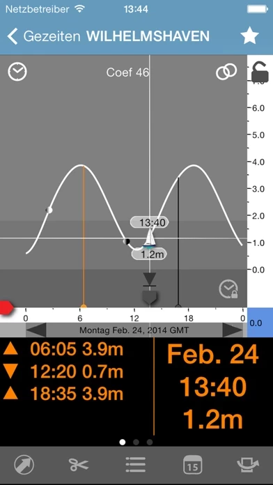
- Tidal graphs
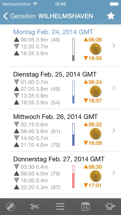
- Week ahead tide table
- Minimum/maximum depths
- Chart depth/actual depth
- Standard port information
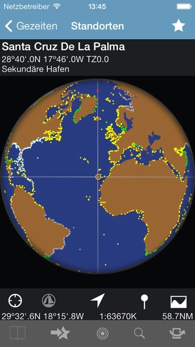
- Spinning globe for rapid location search
- Search by name
- Time of sunrise/sunset, dawn/twilight
- Moon phases, rise/set
- Date of spring/neap tides
- Notepad and copy/paste + email
- Favourites and recents
- Scrolling scales
- Coefficients (France)
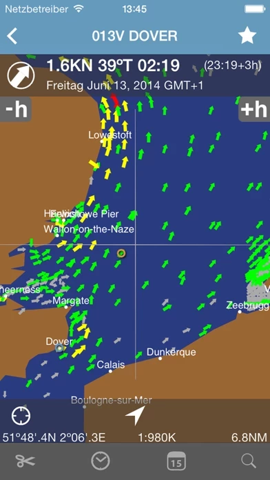
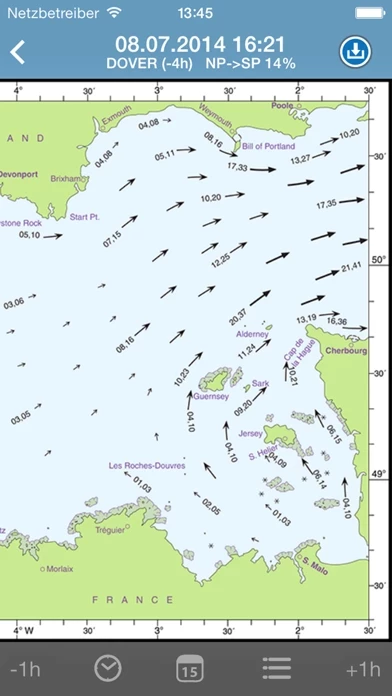
- Currents (UK, Ireland, North Sea, Netherlands and parts of the German coast)
- Hydrographic Office Licences for certain countries to remove restrictions
- Worldwide coverage with some countries having time limits from the national Hydrographic Office
- Available in English, French, German, Italian, Spanish, and Japanese
- Predictions based on the harmonic method, using constants from the Hydro offices (UKHO, SHOM, NOAA, BOM, CHS, etc.)
Official Screenshots
Product Details and Description of
Essential TIDES tool for sailors, divers, canoeists, fishermen, surfers, swimmers, photographers and anyone involved with sport or leisure at the seaside. At the push of a button Tides Planner allows you to see tides for 8,000+ WORLDWIDE locations. NO CONNECTION REQUIRED as the app has its own database. One tap to tides for your favourites. Advanced users can take advantage of extensive tools to calculate time windows for entering/leaving and clearing depths. FEATURES - Tidal graphs - Week ahead tide table - Minimum/maximum depths - Chart depth/actual depth - Standard port information - Spinning globe for rapid location search - Search by name - Time of sunrise/sunset, dawn/twilight - Moon phases, rise/set - Date of spring/neap tides - Notepad and copy/paste + email - Favourites and recents - Scrolling scales - Coefficients (France) - Currents (UK, Ireland, North Sea, Netherlands and parts of the German coast) From version 3.0 enhanced predictions for Europe based on our own constituent analysis system. Other countries to follow. GEOGRAPHIC COVERAGE Worldwide coverage. Some countries have time limits from the national Hydrographic Office. TIME COVERAGE The app gives access to all its features, but the free initial download is limited to tides for one day. To get future predictions use the Extensions within the app (In App purchase): - Year on year: use the extensions within the app (In App purchases) to enable future predictions. - In certain countries get a Hydrographic Licence to remove restrictions. HYDROGRAPHIC OFFICE LICENCES During a valid year: - Italy, USA, Canada (main ports), Australia, New Zealand, Japan and other countries: ANY DAY in the year. - Denmark, Spain, Portugal, South Africa, Oman, Argentina: SEVEN DAYS at a time. The following can be extended with a Hydrographic Office Licence to remove country restrictions: - UK, Ireland, Germany and all UKHO ports: change from seven days to ANY DAY. - Netherlands: change from seven days to ANY DAY. - Belgium: change from seven days to ANY DAY. - France and SHOM ports: from one day to ANY DAY. Each Hydrographic Office Licence is ONLY PURCHASED ONCE and applies to all Valid Years. ABOUT US Imray: publishers of nautical charts, books and apps. Look out for other applications in the Marine Navigation Series from Imray. Follow us on Twitter: http://twitter.com/imray_charts Facebook/Imray-Laurie-Norie-Wilson-Ltd-304115312941493 LANGUAGES English, French, German, Italian, Spanish and Japanese ABOUT PREDICTIONS Predictions are based on the harmonic method, using constants from the Hydro offices (UKHO, SHOM, NOAA, BOM, CHS etc). There are differences between the app predictions and the official Hydro office tide tables, as these are based on large numbers of constants that are not made publicly available. The Hydro offices consider the harmonic methods used in this product appropriate for navigation. Always consult tidal curves and take into account local weather (pressure and wind) and swell conditions, which can have a very significant effect on sea water levels.
Top Reviews
By Alireza Saraei
Best app
Tnx to developer and inform there is a little difference by admiralty.
By C71
Best tide app for the price (but not free)
Best tide app around - really. I'm not sure what the complaining is about. I bought this app when it was $2 up-front (not on the app store), and it has features normally found in similar apps selling for $10-15. Loads of US locations - I count about 20 near Paris Island alone while other apps often just show one. Also it has offline use (no connection required), nice data display, currents ….. I recently killed three other tide apps on my phone since I found I no longer used them since getting this app. As far as I can see, the negative comments are due to the "free" claim. Apparently that is just a limited demo. Probably not a good marketing tactic, but with so many tide apps out there you need some way to try-before-buy. Regardless, the app is a great bargain at the price. (Not affiliated in any way with anyone.)
By Gebroida
Great work fixing it!
Thanks to the entire team for making this app possible. Customer service was very prompt when I told them about the issues the past version was encountering. This new version is running very well showing tides for all the regions. Thanks again.