Active Wildfire Tracker Map Overview
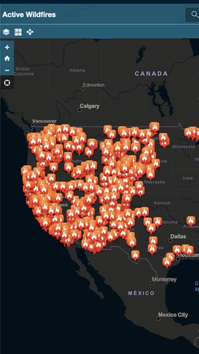
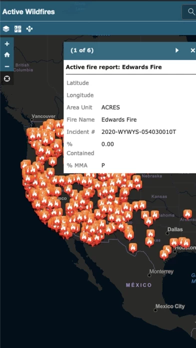
Active Wildfire Tracker Map is an interactive mapping application that tracks the current active wildfires in the US.
Official Screenshots
Product Details and Description of
Active Wildfire Tracker Map is an interactive mapping application that tracks the current active wildfires in the US. The data is updated hourly and offer GPS capabilities.
Top Reviews
By 1st Woody
Help!
The app worked great at first until I received an ad that would not go away and was not in English. If it continues I can’t even use it!
By emjayy103
Quit working
App hasn’t worked in over a week.