Tomstrails GPS UTM Overview
∙ Sharing your current location either as a grid reference, or a link to Google Maps.
∙ Optimal battery use based on speed of travel and current charge level ensures all day use.
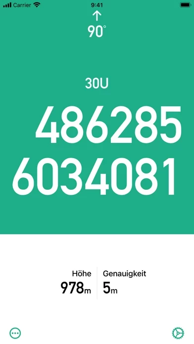
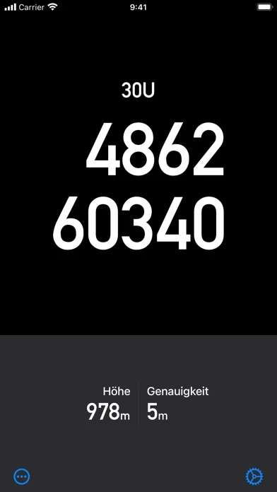
GPS UTM displays an accurate UTM grid reference as marked on many topographic maps.
∙ A large, clear, high contrast display ensures you can easily read your position in any light conditions.
Official Screenshots

Product Details and Description of
GPS UTM displays a fast and accurate UTM grid reference. Locate your position on topographic maps. GPS UTM supports many of the regional datums used around the world including ED50. ∙ No phone signal required - works in the most remote locations. ∙ 1 metre, 10 metre and 100 metre formats. ∙ Paste your coordinate into other apps or share with other people. ∙ A large, clear, high contrast display ensures you can easily read your position in any light conditions. ∙ Optimal battery use based on speed of travel and current charge level ensures all day use. ∙ No Adverts. GPS UTM - know where you are.
Top Reviews
By zorbot_crob
Works, may require some setting-up
Initially, the UTM grids were off. I had to play with the datum settings for North America (selected NAD27). One I made the change and verified on my map, it worked perfectly. Used it to plot a small land nav training course and it was spot on. Great app when you don’t have access to a commercial unit. Bottom line, make sure you verify the grid accuracy before using.
By danielguecosta
Simple as it should be!
Just loved the app. I’ve used in some hiking trails and it worked perfect! Besides because it’s very simple it did not consume much of my phone battery.
By smuft11y
Simple perfect
Just what you need. Only uses GPS. When you have a hiking map and you don’t have cell signal—just what you need.