Iphigénie The Hiking Map App Übersicht
You may use it with no Geoportal valid subscription, dispaying tracks and waypoints on available free maps.
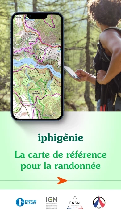
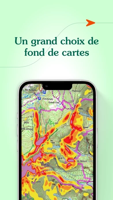
iPhiGéNie is the tool of choice for outdoor maps in FRANCE, BELGIUM, SWISS, Spain, Italy, Germany and Norway.
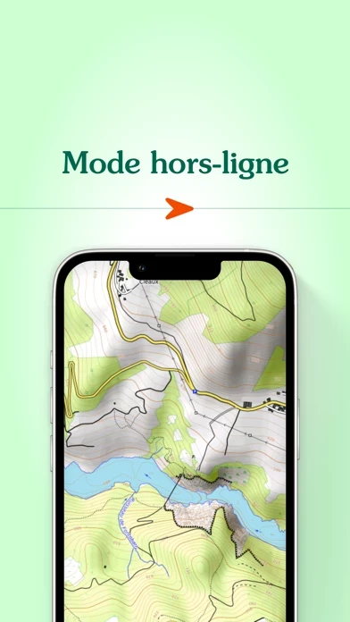
There are GPS applications with French topographic maps inside, iPhiGéNie brings you ALL maps from National Geographic Institute, with a GPS inside.
Gives access to French reference topographics maps, SCAN25 et SCAN100, OACI.
• OACI aviation maps are included in the annual Geoportail subscription.
• Photos and many layers, including "PlanV2" maps, are on permeanent FREE access.
• "GPS beacon" feature: People you authorize can follow your position on topographic maps.
Gives access to topographic maps of BELGIUM.
• Automatic downloading of maps along a predefined track.
Offizielle Bildschirmfotos
Produkt einzelheiten und Beschreibung von
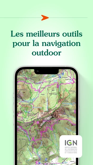
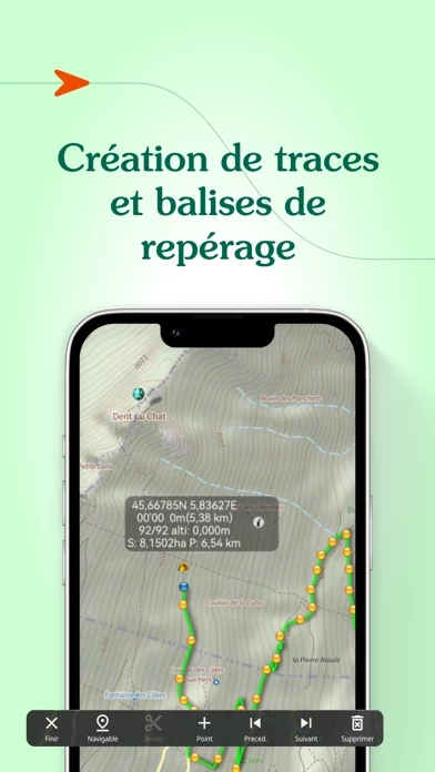
Everyone understands the need for a map; to prepare for an outing, a walk, a hike, a trip or simply to know where you are and about the environment that surrounds you. Iphigénie is a complete mapping app which - thanks to more than 40 maps - will allow you to find your way anywhere in the world. We include some of the most popular maps in the world: - OpenTopoMap (worldwide topography) - OpenSnowMap (worldwide ski slopes) - French IGN topographic national maps - SwissTopo maps - Spanish topographic maps - Norwegian topographic maps and many others*… But much more than just your location on a map, iPhigénie offers you a variety of tools that will allow you to prepare, follow, record, archive and share your outings. PREPARE - download maps for offline access - create, edit, import GPS tracks - position, import useful markers (e.g. avalanche path, mushroom spots….) - 3D view FOLLOW - follow a GPS track (with optional guidance sounds to keep you on-track) - customised vocal alerts - information like distance covered, distance remaining, estimated arrival time - beacon, to allow chosen contacts to follow your outing progress in real time. RECORD - record your track, your position - information like distance covered, elevation gain and loss, average and current speed ARCHIVE - Tracks and markers saved in a folder - Cloud access SHARE - export your tracks and markers in GPX format By selecting iPhiGéNie, you enjoy not only a complete and stable application, but also a customer-focused team available to answer all your questions and assist you as you progress. So, if you encounter any difficulty with the app, do not hesitate to contact us: support(at)xn--iphignie-f1a.com *AVAILABLE MAPS : Note : editor subscription needed for marked “**” maps - IGN France : Topographic and road maps (current, 1950)**, Scan 1/25k all scales**, OACI (aviation)**, ESRI** (worldwide), French satellite view (current, 1950-1965, 2000-2005, 2006-2010), cadastre**, French administrative limits, Plan IGN V2, slopes 30° 35° 40° 45°, restricted drone areas, 19th century maps, Paris satellite view (1818-1824, 1906, 1965-1980). - SwissTopo : Topographic and road maps, satellite view, hiking trails, gliding maps, OACI (aviation), geological maps, slopes >30°. - IGN Belgium : Topographic and road maps (Cartoweb)**. Institut Cartogràfic de Catalunya Topographic maps. - Instituto Geografico Nacional (Spain) : Basic maps, topographic and road maps. - Bundesamt für Kartographie und Geodäsie (Germany) : Topographic and road digital maps - Kartverket (Norway) : Topographic and road maps - OpenTopoMap.org (worldwide) : OpenTopoMap. - OpenCycleMap (worldwide) : OpenCycleMap, landscape, transport, outdoor. OpenSnowMap (worldwide) Ski areas, pistes and trails. - Geological and Mineral Research Bureau (France) : Geological maps. - Forests National Office (France) : Public forest delimits, public forest plots. NOTES: Beacon : WARNING, do not rely solely on this feature for safety. Planning, communication and knowledge are the ultimate tools for safety in the mountains. Apple Store subscriptions are recurrent, their renewal is automatic. ** Editor subscription required *** Vmax module purchase is required to access iPhiGéNie’s tools (this is not a subscription) – without Vmax module you only get access to your location on the map.
Oben Erfahrungen und Bewertung
durch User39221
Unübertroffenes Kartenmaterial, Lizenzgebühr für die Karten angemessen
Schon die Vorgängerversion hat mir bei Radtouren in Frankreich gute Dienste geleistet, in Version 3 sind noch tolle Funktionen hinzu gekommen (u.a. Routen erstellen und ändern - auch importierte - und in beliebiger Richtung abfahren). Ich habe zahllose Apps zur Fahrradnavigation ausprobiert, und für Frankreich gibt es einfach nichts Besseres! Die App selbst ist kostenfrei nutzbar. EUR 4,99 fallen nur für die Freischaltung von Zusatzfunktionen an, wie z.B. für den komfortableren vorherigen Download von Kartendaten. Auf 30 Tage beschränkt ist lediglich die Lizenz für die Benutzung der Kartendaten des IGN (Institut Géographique National). Die Verlängerung der Kartenlizenz um ein Jahr kostet faire EUR 13,99 - für den Preis bekomme ich gerade mal anderthalb Wanderkarten auf Papier! Die teilweise wütenden Kommentare ("Abzocke!") kann ich daher nicht verstehen - alle diese Informationen stehen schließlich in der Produktbeschreibung ...
durch Frankie_64
Alle IGN Karten immer dabei - Traum
Die App ist echt genial, anstelle Dutzender IGN Karten aus unterschiedlichen Jahren haben wir damit immer alle aktuellen dabei. Der Preis ist zwar happig, im Vergleich zu den Karten aber gerechtfertigt. Dabei sollte auch bedacht werden, dass die Gebühren für das Geoportal direkt an das IGN gehen. Die Anleitung wird direkt mit Google Translate übersetzt, daher leidet sie unter der miesen Qualität von Französisch nach Deutsch. Im Zweifelsfall mal die Übersetzung nach Englisch ausprobieren, dort gibt sich Google mehr Mühe, den Zusammenhang korrekt zu übersetzen. Interessant ist auch die Downloadfunktion, diese kostet leider aufgrund von IGN Vorgaben extra und ist nur für Jahresabos verfügbar. Super ist auch die Überblendung auf die Luftfotos, dort stehen für ganz Frankreich hochauflösende Bilder und auch Meßtischblätter zur Verfügung. Im Vergleich dazu bietet Google nur matschige Aufnahmen an.
durch Dreiländereck
Genial! Für Frankreich nichts besseres!
Die besten topografischen Karten vom staatl. IGN. Schon der Kauf einer Karte im Buchladen gleicht die über die schon klasse und kostenlose Grundversion hinausgehenden Kosten aus. Und hier habt Ihr alle Karten in allen Maßstäben, ohne Papier schleppen zu müssen. Verbesserungswürdig allerdings: die deutsche Roboterübersetzung der Anleitung, auf die man aber verzichten kann.