GPX viewer Übersicht
Display them on different preset maps (plan, satellite, OpenStreetMap, OpenTopoMap, Swisstopo) or on your own custom maps.
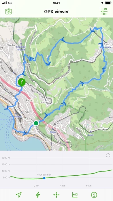
Offizielle Bildschirmfotos


Produkt einzelheiten und Beschreibung von
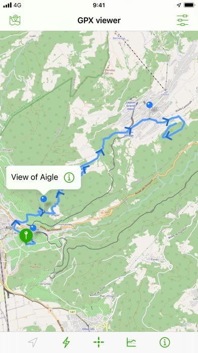
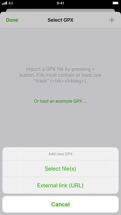
Import your routes in GPX format (tracks or routes) into the application. Display them on different preset maps (plan, satellite, OpenStreetMap, OpenTopoMap, Swisstopo, IGN) or on your own custom maps. Display an elevation graph to evaluate their difficulty. And check out all of their information. Follow your position along the route during your ride. You can also display points of interest from GPX. All what you need to go hiking and follow your route. All for free and without ads. The only in-app purchases are tips for few other features, take a look. Features details: - Import of GPX files via file or web link - Management of imported GPX (library) - Display GPX track on the map (track and route) - Several base maps: map, hybrid, satellite 3D, OpenStreetMap, OpenTopoMap, Swisstopo - Possibility to set your own custom maps from a library or manually - Possibility to download maps for offline use - Displayed on the map: current position, start and end of the route, points of interest along the route, scale, route direction - Choice of color and size of the route - Locking of screen standby to better follow the route - Map cache system - Display of GPX details: name, description, longitudinal profile, elevation differences, distance, image gallery, link, points of interest - Display details of a point of interest: name, description, image gallery, links - Access to the route via Maps, Google Maps or Waze - Sharing a GPX - GPX editor - Speedometer Note: If the application cannot open a GPX file, contact me by sending me the file.
Oben Erfahrungen und Bewertung
durch Schlausibär
GPX Import und Positionsermittlung funktioniert!
Bin sehr zufrieden mit dieser App. GPX Import funktioniert und die Darstellung der eigenen Position lässt sich über die Konfiguration „Your Position“ aktivieren. Klassische Karte oder Hybriddarstellung mit Satellitenbild möglich. Hat uns auf der Fahrradtour sehr weitergeholfen.
durch RikGaming
Funktioniert klasse
Sehr einfach gps Routen von Webseiten aufzurufen. Und eine schöne Darstellung der Karte :) Hilft beim Wandern toll weiter sich nicht zu verkaufen !
durch Dispatcher71
Top GPX Tool
Sehr gutes Tool um Tracks einfach und übersichtlich darzustellen. Ohne Werbung und für eine kleine Spende gibt’s den vollen Nutzungsumfang 👍🏼