Blueturn Übersicht
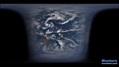
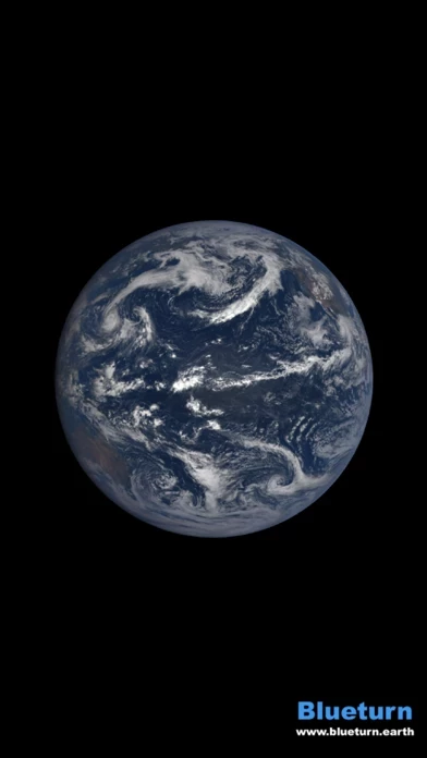
It is generated using real images from deep space, by a satellite of NASA called DSCOVR, located at Lagrange point L1, one million miles away from us.
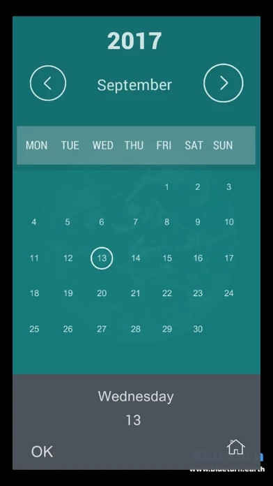
You can browse the video interactively, and access a huge public database of images of the Earth at every instant since Summer 2015.
See the real Earth from a geostationary viewpoint, to better see the clouds moving, and get a 3D interactive weather animation.
Using an accurate 3D model of the Earth and its neighborhood, the app now allows to switch between vantage points.
Offizielle Bildschirmfotos
Produkt einzelheiten und Beschreibung von
This is the real Earth. Check our website for our vision and achievements: http://diese App.earth/ This is the most complete and real video you can get on a screen today. It is generated using real images from deep space, by a satellite of NASA called DSCOVR, located at Lagrange point L1, one million miles away from us. This vantage point is at a gravity equilibrium between the Earth and the Sun, always on the line between them. Therefore its camera, called EPIC, always see the fully sun-lit, day side of our planet, rotating in 24 hours. *Relax*. Just sit and watch, that's the main point. Some nice music will escort you through this kind of meditation. Just let it go. It's our world down here you're watching. *See the past*. You can browse the video interactively, and access a huge public database of images of the Earth at every instant since Summer 2015. See how the Earth tilt angle from the Sun changes through the seasons. You can bookmark noticeable events, like solstices, weather events, eclipses or even Moon crossings. *Clouds are moving*. It may be hard to see at first, but clouds are moving, just relatively slowly compared to the Earth rotation. However if you sit and watch the Earth as it turns around, you will see the "fluidity" of the atmosphere. It is an unprecedented, mesmerizing viewing experience. *Know where you are*. Using an accurate 3D model of the Earth and its neighborhood, the app now allows to switch between vantage points. Zoom out enough and you will see the satellite, the Moon, the L1 point and the Sun. You will see the Moon's orbit at well as the exact Lissajous path of the satellite around L1, with the interference of the Moon's gravity. *Choose your reference*. See the real Earth from a geostationary viewpoint, to better see the clouds moving, and get a 3D interactive weather animation. You can even unfold the Earth into a 2D map, using various projections patterns (Mercator or Plate-Carrée). *Enhance your view*. You can switch away from the real images and apply some filter to better see the lands. Use for your own good, the good of Mankind and the good of the Earth, by extending your environmental consciousness while seeing it everyday and everywhere. The app is free, the images are public, and we refuse to put ads, as we want to keep the view as pure and naked as possible. More tech details on our FAQ: http://diese App.earth/tech/#faq