How to Cancel bergfex
Published by bergfex GmbH on 2023-12-18We have made it super easy to cancel bergfex: hiking & tracking subscription
at the root to avoid any and all mediums "bergfex GmbH" (the developer) uses to bill you.
Complete Guide to Canceling bergfex: hiking & tracking
A few things to note and do before cancelling:
- The developer of bergfex is bergfex GmbH and all inquiries must go to them.
- Cancelling a subscription during a free trial may result in losing a free trial account.
- You must always cancel a subscription at least 24 hours before the trial period ends.
How easy is it to cancel or delete bergfex?
It is Difficult to Cancel a bergfex subscription. (**Crowdsourced from bergfex and Justuseapp users)
If you haven't rated bergfex cancellation policy yet, Rate it here →.
Potential Savings
**Pricing data is based on average subscription prices reported by Justuseapp.com users..
| Duration | Amount (USD) |
|---|---|
| If Billed Once | $5.00 |

How to Cancel bergfex: hiking & tracking Subscription on iPhone or iPad:
- Open Settings » ~Your name~ » and click "Subscriptions".
- Click the bergfex (subscription) you want to review.
- Click Cancel.
How to Cancel bergfex: hiking & tracking Subscription on Android Device:
- Open your Google Play Store app.
- Click on Menu » "Subscriptions".
- Tap on bergfex: hiking & tracking (subscription you wish to cancel)
- Click "Cancel Subscription".
How do I remove my Card from bergfex?
Removing card details from bergfex if you subscribed directly is very tricky. Very few websites allow you to remove your card details. So you will have to make do with some few tricks before and after subscribing on websites in the future.
Before Signing up or Subscribing:
- Create an account on Justuseapp. signup here →
- Create upto 4 Virtual Debit Cards - this will act as a VPN for you bank account and prevent apps like bergfex from billing you to eternity.
- Fund your Justuseapp Cards using your real card.
- Signup on bergfex: hiking & tracking or any other website using your Justuseapp card.
- Cancel the bergfex subscription directly from your Justuseapp dashboard.
- To learn more how this all works, Visit here →.
How to Cancel bergfex: hiking & tracking Subscription on a Mac computer:
- Goto your Mac AppStore, Click ~Your name~ (bottom sidebar).
- Click "View Information" and sign in if asked to.
- Scroll down on the next page shown to you until you see the "Subscriptions" tab then click on "Manage".
- Click "Edit" beside the bergfex: hiking & tracking app and then click on "Cancel Subscription".
What to do if you Subscribed directly on bergfex's Website:
- Reach out to bergfex GmbH here »»
- If the company has an app they developed in the Appstore, you can try contacting bergfex GmbH (the app developer) for help through the details of the app.
How to Cancel bergfex: hiking & tracking Subscription on Paypal:
To cancel your bergfex subscription on PayPal, do the following:
- Login to www.paypal.com .
- Click "Settings" » "Payments".
- Next, click on "Manage Automatic Payments" in the Automatic Payments dashboard.
- You'll see a list of merchants you've subscribed to. Click on "bergfex: hiking & tracking" or "bergfex GmbH" to cancel.
How to delete bergfex account:
- Reach out directly to bergfex via Justuseapp. Get all Contact details →
- Send an email to [email protected] Click to email requesting that they delete your account.
Delete bergfex: hiking & tracking from iPhone:
- On your homescreen, Tap and hold bergfex: hiking & tracking until it starts shaking.
- Once it starts to shake, you'll see an X Mark at the top of the app icon.
- Click on that X to delete the bergfex: hiking & tracking app.
Delete bergfex: hiking & tracking from Android:
- Open your GooglePlay app and goto the menu.
- Click "My Apps and Games" » then "Installed".
- Choose bergfex: hiking & tracking, » then click "Uninstall".
Have a Problem with bergfex: hiking & tracking? Report Issue
Leave a comment:
Reviews & Common Issues: 1 Comments
By Pekka Aroviita
3 years agoHello, I just subscribed (16.1.2021) the bergfex Touren pro as the app offered a one month trial period. However my Apple account was charged immediately. I need the trial period to verify the suitability of the maps in Finland. Can you set the trial period on and return the charged eur 9.99? Thanks! BR Pekka Aroviita
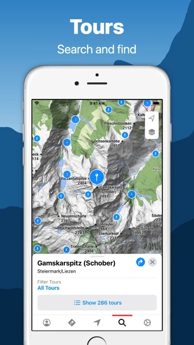
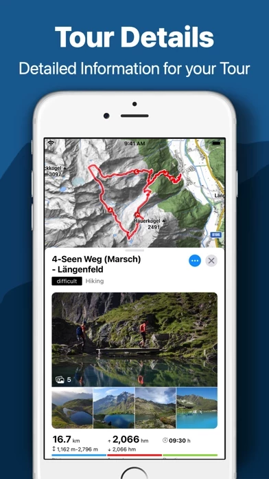
What is bergfex: hiking & tracking?
◄ this app Outdoor Tracking & Tours App ► The perfect ALL-IN-ONE tool for all your outdoor activities. Use it for Hiking, Mountain Biking, Running, Cycling, Climbing, Nordic walking, Ski Tours, Fitness and much more. Your Tool for tracking and planning your tours: ● detailed topographical maps for Europe ● more than 70.000 GPS-Tours ● great search functionality ● offline maps (PRO-Version) ● navigation-tool for planning your personal tours ● possibility to create your personal sectors ● connectivity for bluetooth watches or chest straps ● websync with myBergfex account ● save your favourite tours ● GPX export/import ● iPad support ● AppleWatch support ● Heatmap › Use the Tours App as a activity or fitness tracker (with pulse recording function and pulse zones in pro version). › Choose one of more than 70.000 detailed hiking tours, mountain bike tours, running courses, ski tours, cycling routes and much more › inform yourself about length, height, duration, etc. to get a detailed description with photos of the tour (if you are going to hike or ride a selected tour you can use our way-leaving-function to get a warning if you once missed the right way). › Download your maps offline on your smartphone (PRO Version) so you will not need a mobile or internet connection for navigation any more. › Plan your personal tour from any start point to your preferred top of the mountain (this is also possible with different waypoints - in PRO Version). › You can define your pe...